179th meridian west
.svg.png)
179°
179th meridian west ()
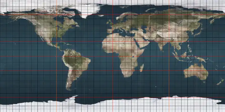
The meridian 179° west of Greenwich is a line of longitude[1] that extends from the North Pole across the Arctic Ocean, Asia, the Pacific Ocean, the Southern Ocean, and Antarctica to the South Pole.
The 179th meridian west forms a great ellipse with the 1st meridian east.
From Pole to Pole
Starting at the North Pole and heading south to the South Pole, the 179th meridian west passes through:
Co-ordinates Country, territory or sea Notes 90°0′N 179°0′W / 90.000°N 179.000°W Arctic Ocean 71°36′N 179°0′W / 71.600°N 179.000°W 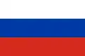 Russia
Chukotka Autonomous Okrug — Wrangel Island 70°55′N 179°0′W / 70.917°N 179.000°W Chukchi Sea 68°47′N 179°0′W / 68.783°N 179.000°W Russia
Chukotka Autonomous Okrug 66°10′N 179°0′W / 66.167°N 179.000°W Bering Sea Passing just west of Gareloi Island, Alaska, .png) United States (at 51°47′N 178°52′W / 51.783°N 178.867°W)
United States (at 51°47′N 178°52′W / 51.783°N 178.867°W)
Passing just east of Unalga Island, Alaska, United States (at 51°35′N 179°1′W / 51.583°N 179.017°W)
Passing just west of Kavalga Island, Alaska, United States (at 51°34′N 178°51′W / 51.567°N 178.850°W)
Passing just west of Ulak Island, Alaska, United States (at 51°22′N 178°59′W / 51.367°N 178.983°W)
Passing just east of Amatignak Island, Alaska, United States (at 51°15′N 179°3′W / 51.250°N 179.050°W)
51°17′N 179°0′W / 51.283°N 179.000°W Pacific Ocean Passing just east of the island of Qelelevu,  Fiji (at 16°5′S 179°9′W / 16.083°S 179.150°W)
17°10′S 179°0′W / 17.167°S 179.000°W Fiji
Island of Vanua Balavu 17°12′S 179°0′W / 17.200°S 179.000°W Pacific Ocean Passing just east of the island of Mago, Fiji (at 17°27′S 179°8′W / 17.450°S 179.133°W)
Passing just west of the island of Tuvuca, Fiji (at 17°40′S 178°50′W / 17.667°S 178.833°W)
Passing just east of the island of Nayau, Fiji (at 18°0′S 179°2′W / 18.000°S 179.033°W)
Passing just west of the island of Lakeba, Fiji (at 18°12′S 178°50′W / 18.200°S 178.833°W)
Passing just west of the island of Vuaqava, Fiji (at 18°53′S 178°55′W / 18.883°S 178.917°W)
Passing just west of the island of Kabara, Fiji (at 18°57′S 178°59′W / 18.950°S 178.983°W)
Passing just west of the island of Ono-i-Lau, Fiji (at 20°39′S 178°44′W / 20.650°S 178.733°W)
60°0′S 179°0′W / 60.000°S 179.000°W Southern Ocean 78°19′S 179°0′W / 78.317°S 179.000°W Antarctica Ross Dependency, claimed by 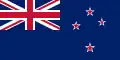 New Zealand
See also
References
- ^ "What is longitude?". oceanservice.noaa.gov. Retrieved 1 July 2025.