Aghcheh Rish, Charuymaq
Aghcheh Rish
Persian: اغچه ريش | |
|---|---|
Village | |
 Aghcheh Rish | |
| Coordinates: 37°04′57″N 47°22′03″E / 37.08250°N 47.36750°E[1] | |
| Country | Iran |
| Province | East Azerbaijan |
| County | Charuymaq |
| District | Shadian |
| Rural District | Charuymaq-e Sharqi |
| Population (2016)[2] | |
• Total | 384 |
| Time zone | UTC+3:30 (IRST) |
Aghcheh Rish (Persian: اغچه ريش)[a] is a village in Charuymaq-e Sharqi Rural District of Shadian District in Charuymaq County, East Azerbaijan province, Iran, serving as capital of both the district[4] and the rural district.[5]
Demographics
Population
At the time of the 2006 National Census, the village's population was 389 in 59 households.[6] The following census in 2011 counted 409 people in 90 households.[7] The 2016 census measured the population of the village as 384 people in 112 households.[2]
See also
![]() Iran portal
Iran portal
Notes
References
- ^ OpenStreetMap contributors (15 January 2025). "اغچه ریش, دهستان چاراویماق شرقی, بخش شادیان [Aghcheh Rish, Charuymaq-e Sharqi Rural District, Shadian District], Charoymagh City, Iran" (Map). OpenStreetMap (in Persian). Retrieved 15 January 2025.
- ^ a b سرشماري عمومي نفوس و مسكن 1395 : استان آذربایجان شرقی [General Population and Housing Census 2016: East Azerbaijan Province]. مرکز آمار ایران [Statistical Centre of Iran] (in Persian). Archived from the original (Excel) on 13 November 2020. Retrieved 19 December 2022.
- ^ Aghcheh Rish can be found at GEOnet Names Server, at this link, by opening the Advanced Search box, entering "-3803652" in the "Unique Feature Id" form, and clicking on "Search Database".
- ^ Habibi, Hassan (6 September 2000) [تاریخ تصویب (Approval date) 1379/06/16 (Iranian Jalali calendar)]. ایجاد تغییرات و اصلاحات تقسیماتی در استان آذربایجان شرقی [Making divisional changes and reforms in East Azerbaijan province]. لام تا کام [Lam ta Kam] (in Persian). وزارت کشور [Ministry of the Interior]. هیات وزیران [Council of Ministers]. شناسه [ID] E5DA4421-A411-4C69-A296-FC208365F0CF. شماره دوره [Course number] 79. Archived from the original on 4 December 2023. Retrieved 8 September 2025.
- ^ Mousavi, Mir-Hossein (9 August 1987) [تاریخ تصویب (Approval date) 1366/05/18 (Iranian Jalali calendar)]. ایجاد و تشکیل 14 دهستان شامل روستاها، مزارع و مکانها در شهرستان هشترود تابع استان آذربایجان شرقی [Establishment and formation of 14 rural districts including villages, farms and places in Hashtrud County, East Azerbaijan province]. لام تا کام [Lam ta Kam] (in Persian). وزارت کشور [Ministry of the Interior]. هیات وزیران [Council of Ministers]. شناسه [ID] 78428C35-3F62-497B-BDC1-77D3305A8695. شماره دوره [Course number] 66, شماره جلد [Volume number] 13. Archived from the original on 8 September 2025. Retrieved 8 September 2025.
- ^ سرشماري عمومي نفوس و مسكن 1385 : استان آذربایجان شرقی [General Population and Housing Census 2006: East Azerbaijan Province]. مرکز آمار ایران [Statistical Centre of Iran] (in Persian). Archived from the original (Excel) on 20 September 2011. Retrieved 25 September 2022.
- ^ سرشماري عمومي نفوس و مسكن 1390 : استان آذربایجان شرقی [General Population and Housing Census 2011: East Azerbaijan Province]. Iran Data Portal—Syracuse University (in Persian). مرکز آمار ایران [Statistical Centre of Iran]. Archived from the original (Excel) on 16 January 2023. Retrieved 19 December 2022.
| Capital | 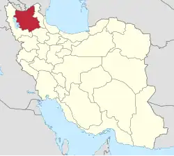 | ||||||||||||||||||||||||||||||||||||||||
|---|---|---|---|---|---|---|---|---|---|---|---|---|---|---|---|---|---|---|---|---|---|---|---|---|---|---|---|---|---|---|---|---|---|---|---|---|---|---|---|---|---|
| Counties and cities |
| ||||||||||||||||||||||||||||||||||||||||
| Landmarks and Sights |
| ||||||||||||||||||||||||||||||||||||||||
| Places |
| ||||||||||||||||||||||||||||||||||||||||