Dodangeh Rural District (Hurand County)
Dodangeh Rural District
Persian: دهستان دودانگه | |
|---|---|
Rural District | |
 Dodangeh Rural District | |
| Coordinates: 38°53′N 47°24′E / 38.883°N 47.400°E[1][2] | |
| Country | Iran |
| Province | East Azerbaijan |
| County | Hurand |
| District | Central |
| Established | 1987[3] |
| Capital | Hurand |
| Population (2016)[4] | |
• Total | 5,260 |
| Time zone | UTC+3:30 (IRST) |
Dodangeh Rural District (Persian: دهستان دودانگه)[5] is in the Central District of Hurand County, East Azerbaijan province, Iran.[6] It is administered from the city of Hurand.[3]
Demographics
Population
At the time of the 2006 National Census, the rural district's population (as a part of the former Hurand District in Ahar County) was 6,394 in 1,372 households.[7] There were 5,430 inhabitants in 1,502 households at the following census of 2011.[8] The 2016 census measured the population of the rural district as 5,260 in 1,625 households. The most populous of its 45 villages was Injar, with 708 people.[4]
In 2018, the district was separated from the county in the establishment of Hurand County, and the rural district was transferred to the new Central District.[6]
Other villages in the rural district
See also
![]() Iran portal
Iran portal
References
- ^ OpenStreetMap contributors (11 September 2025). "Hurand, دهستان دودانگه, بخش مرکزی شهرستان هوراند [Dodangeh Rural District, Central District of Hurand County], Hurand, Iran" (Map). OpenStreetMap (in Persian). Retrieved 11 September 2025.
- ^ "VCM2+82J Sheylavan, Iran" (Map). Google Maps. Retrieved 11 September 2025.
- ^ a b Mousavi, Mir-Hossein (9 August 1987) [تاریخ تصویب (Approval date) 1366/05/18 (Iranian Jalali calendar)]. ایجاد و تشکیل تعداد 30 دهستان شامل روستاها، مزارع و مکانها در شهرستان اهر تابع استان آذربایجان شرقی [Creation and formation of 30 rural districts including villages, farms and places in Ahar County under East Azerbaijan province]. لام تا کام [Lam ta Kam] (in Persian). وزارت کشور [Ministry of the Interior]. هیات وزیران [Council of Ministers]. شناسه [ID] 1F7402E2-5CAC-4D1B-B0FF-D19D6D096C79. شماره دوره [Course number] 66, شماره جلد [Volume number] 11. Archived from the original on 19 June 2025. Retrieved 19 June 2025.
- ^ a b سرشماري عمومي نفوس و مسكن 1395 : استان آذربایجان شرقی [General Population and Housing Census 2016: East Azerbaijan Province]. مرکز آمار ایران [Statistical Centre of Iran] (in Persian). Archived from the original (Excel) on 13 November 2020. Retrieved 19 December 2022.
- ^ "INCSGN Search". Iranian National Committee for Standardization of Geographical Names (in Persian). Tehran: National Cartographic Center of Iran. Archived from the original on 2 May 2019.
- ^ a b Jahangiri, Eshaq (4 November 2018) [تاریخ تصویب : 1397/08/13 (Date of Approval: 1397/08/13) (Iranian Jalali calendar)]. تصویب نامه درخصوص اصلاحات و تغییرات تقسیماتی در استان آذربایجان شرقی [Resolution on divisional reforms and changes in East Azerbaijan province]. مرکز پژوهشهای مجلس شورای اسلامی ایران [Research Center of the Islamic Consultative Assembly of Iran] (in Persian). وزارت کشور [Ministry of the Interior]. هیات وزیران [Council of Ministers]. پیشنهاد شماره ۱۳۶۱۳۰ [Proposal Number 136130]. Archived from the original on 6 October 2021. Retrieved 4 September 2025.
- ^ سرشماري عمومي نفوس و مسكن 1385 : استان آذربایجان شرقی [General Population and Housing Census 2006: East Azerbaijan Province]. مرکز آمار ایران [Statistical Centre of Iran] (in Persian). Archived from the original (Excel) on 20 September 2011. Retrieved 25 September 2022.
- ^ سرشماري عمومي نفوس و مسكن 1390 : استان آذربایجان شرقی [General Population and Housing Census 2011: East Azerbaijan Province]. Iran Data Portal—Syracuse University (in Persian). مرکز آمار ایران [Statistical Centre of Iran]. Archived from the original (Excel) on 16 January 2023. Retrieved 19 December 2022.
| Capital | 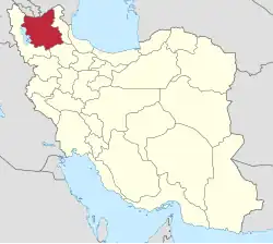 | ||||||||||||||||||||||||||||||||||||||||
|---|---|---|---|---|---|---|---|---|---|---|---|---|---|---|---|---|---|---|---|---|---|---|---|---|---|---|---|---|---|---|---|---|---|---|---|---|---|---|---|---|---|
| Counties and cities |
| ||||||||||||||||||||||||||||||||||||||||
| Landmarks and Sights |
| ||||||||||||||||||||||||||||||||||||||||
| Places |
| ||||||||||||||||||||||||||||||||||||||||