Haleh, Iran
Haleh
Persian: هاله | |
|---|---|
Village | |
 Haleh | |
| Coordinates: 27°23′48″N 52°38′21″E / 27.39667°N 52.63917°E[1] | |
| Country | Iran |
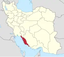
| Province | Bushehr |
| County | Asaluyeh |
| District | Chah-e Mobarak |
| Rural District | Nayband |
| Population (2016)[2] | |
• Total | 986 |
| Time zone | UTC+3:30 (IRST) |
Haleh (Persian: هاله)[a] is a village in Nayband Rural District[4] of Chah-e Mobarak District in Asaluyeh County, Bushehr province, Iran.
Demographics
Population
At the time of the 2006 National Census, the village's population was 641 in 97 households, when it was in the former Asaluyeh District of Kangan County.[5] The following census in 2011 counted 726 people in 130 households.[6] The 2016 census measured the population of the village as 986 people in 233 households,[2] by which time the district had been separated from the county in the establishment of Asaluyeh County. The rural district was transferred to the new Chah-e Mobarak District.[7]
See also
![]() Iran portal
Iran portal
Notes
References
- ^ OpenStreetMap contributors (1 March 2025). "Haleh, دهستان نای بند, بخش چاه مبارک [Nayband Rural District, Chah-e Mobarak District], Asaluyeh County, Bushehr Province, Iran" (Map). OpenStreetMap (in Persian). Retrieved 1 March 2025.
- ^ a b سرشماري عمومي نفوس و مسكن 1395 : استان بوشهر [General Population and Housing Census 2016: Bushehr Province]. مرکز آمار ایران [Statistical Centre of Iran] (in Persian). Archived from the original (Excel) on 3 August 2017. Retrieved 17 June 2025.
- ^ Haleh can be found at GEOnet Names Server, at this link, by opening the Advanced Search box, entering "-3065666" in the "Unique Feature Id" form, and clicking on "Search Database".
- ^ Mousavi, Mir-Hossein (9 November 1986) [تاریخ تصویب (Approval date) 1365/08/18 (Iranian Jalali calendar)]. ایجاد و تشکیل تعداد 5 دهستان شامل روستاها، مزارع و مکانها در شهرستان کنگان تابع استان بوشهر [Creation and formation of five rural districts including villages, farms and places in Kangan County, Bushehr province]. لام تا کام [Lam ta Kam] (in Persian). وزارت کشور [Ministry of the Interior]. هیات وزیران [Council of Ministers]. شناسه [ID] 676C2980-045C-4D6B-A80C-B0AFBB7C69B8. شماره دوره [Course number] 65, شماره جلد [Volume number] 5. Archived from the original on 26 April 2024. Retrieved 13 June 2025.
- ^ سرشماري عمومي نفوس و مسكن 1385 : استان بوشهر [General Population and Housing Census 2006: Bushehr Province]. مرکز آمار ایران [Statistical Centre of Iran] (in Persian). Archived from the original (Excel) on 20 September 2011. Retrieved 17 June 2025.
- ^ سرشماري عمومي نفوس و مسكن 1390 : استان بوشهر [General Population and Housing Census 2011: Bushehr Province]. Iran Data Portal—Syracuse University (in Persian). مرکز آمار ایران [Statistical Centre of Iran]. Archived from the original (Excel) on 3 April 2023. Retrieved 17 June 2025.
- ^ Rahimi, Mohammad Reza (1 January 2013) [تاریخ ابلاغ (Notification date) 1391/10/12 (Iranian Jalali calendar)]. تصویب نامه درخصوص تقسیمات کشوری در استان بوشهر وزارت کشور [Resolution on national divisions in Bushehr province]. مرکز پژوهشهای مجلس شورای اسلامی ایران [Research Center of the Islamic Consultative Assembly of Iran] (in Persian). وزارت کشور [Ministry of the Interior]. هیات وزیران [Council of Ministers]. شماره ابلاغیه [Notification Number] 200653/T46432H. Archived from the original on 10 January 2013. Retrieved 14 June 2025.
Bushehr province, Iran | |||||||||||||||||||||
|---|---|---|---|---|---|---|---|---|---|---|---|---|---|---|---|---|---|---|---|---|---|
| Capital |
|  | |||||||||||||||||||
| Counties and cities |
| ||||||||||||||||||||
| Landmarks |
| ||||||||||||||||||||
| populated places |
| ||||||||||||||||||||
| Capital |
| ||||||||||||||||||||
|---|---|---|---|---|---|---|---|---|---|---|---|---|---|---|---|---|---|---|---|---|---|
| Districts |
| ||||||||||||||||||||