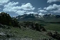
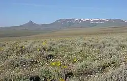
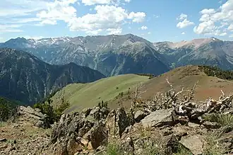
The Calapooya Mountains in Lane County Mount Thielsen in the Cascade Range in southern Oregon The Pueblo Mountains south of Fields Trout Creek Mountains, Southeastern Oregon The Wallowa Mountains in northeastern Oregon There are at least 50 named mountain ranges in the U.S. state of Oregon. Many of these ranges extend into the neighboring states of California, Idaho, Nevada, and Washington. Elevations and coordinates are from the U.S. Geological Survey, Geographic Names Information System, unless otherwise indicated.
range
county
elevation
coordinate
GNIS citation
ft
m
Aldrich Mountains
Grant County, Oregon
6,214
1,894
44°18′55″N 119°18′29″W / 44.31528°N 119.30806°W / 44.31528; -119.30806 (Aldrich Mountains ) [ 1]
Bilk Creek Mountains
Harney County, Oregon
5,535
1,687
41°40′28″N 118°19′25″W / 41.67444°N 118.32361°W / 41.67444; -118.32361 (Bilk Creek Mountains ) [ 2]
Black Hills
Lake County, Oregon
5,111
1,558
43°10′10″N 120°40′48″W / 43.16944°N 120.68000°W / 43.16944; -120.68000 (Black Hills ) [ 3]
Blue Mountains Union County, Oregon
9,108
2,776
45°30′00″N 118°00′05″W / 45.50000°N 118.00139°W / 45.50000; -118.00139 (Blue Mountains ) [ 4]
Buck Mountain
Crook County, Oregon
5,213
1,589
43°42′52″N 119°48′44″W / 43.71444°N 119.81222°W / 43.71444; -119.81222 (Buck Mountain ) [ 5]
Calapooya Mountains Douglas County, Oregon
3,996
1,218
43°29′59″N 122°30′04″W / 43.49972°N 122.50111°W / 43.49972; -122.50111 (Calapooya Mountains ) [ 6]
Canby Mountains
Klamath County, Oregon
4,938
1,505
42°31′29″N 121°49′29″W / 42.52472°N 121.82472°W / 42.52472; -121.82472 (Canby Mountains ) [ 7]
Cardwell Hills
Benton County, Oregon
1,952
595
44°38′34″N 123°22′24″W / 44.64278°N 123.37333°W / 44.64278; -123.37333 (Cardwell Hills ) [ 8]
Cascade Range or The Cascades or Oregon Cascades
Marion County, Oregon
14,409
4,392
46°51′10″N 121°45′37″W / 46.85278°N 121.76028°W / 46.85278; -121.76028 (Cascade Range ) [ 9]
Chehalem Mountains
Yamhill County, Oregon
1,325
404
45°22′34″N 123°02′14″W / 45.37611°N 123.03722°W / 45.37611; -123.03722 (Chehalem Mountains ) [ 10]
Coast Ranges
Coburg Hills
Lane County, Oregon
1,299
396
44°10′23″N 122°55′29″W / 44.17306°N 122.92472°W / 44.17306; -122.92472 (Coburg Hills ) [ 11]
Coleman Hills
Lake County, Oregon
5,102
1,555
42°47′50″N 120°04′54″W / 42.79722°N 120.08167°W / 42.79722; -120.08167 (Coleman Hills ) [ 12]
Connley Hills
Lake County, Oregon
5,269
1,606
43°15′29″N 121°00′34″W / 43.25806°N 121.00944°W / 43.25806; -121.00944 (Connley Hills ) [ 13]
Cottonwood Mountain
Malheur County, Oregon
6,476
1,974
44°10′07″N 117°39′44″W / 44.16861°N 117.66222°W / 44.16861; -117.66222 (Cottonwood Mountain ) [ 14]
Coyote Hills
Baker County, Oregon
3,671
1,119
44°55′15″N 117°54′04″W / 44.92083°N 117.90111°W / 44.92083; -117.90111 (Coyote Hills ) [ 15]
Crooked Creek Range
Malheur County, Oregon
4,206
1,282
42°34′00″N 118°02′38″W / 42.56667°N 118.04389°W / 42.56667; -118.04389 (Crooked Creek Range ) [ 16]
Crowcamp Hills
Harney County, Oregon
5,617
1,712
43°31′30″N 118°30′09″W / 43.52500°N 118.50250°W / 43.52500; -118.50250 (Crowcamp Hills ) [ 17]
Elkhorn Mountains Baker County, Oregon
9,108
2,776
44°52′20″N 118°11′34″W / 44.87222°N 118.19278°W / 44.87222; -118.19278 (Elkhorn Mountains ) [ 18]
Eola Hills
Yamhill County, Oregon
833
254
45°04′31″N 123°07′25″W / 45.07528°N 123.12361°W / 45.07528; -123.12361 (Eola Hills ) [ 19]
Farley Hills
Baker County, Oregon
4,022
1,226
44°57′55″N 117°48′14″W / 44.96528°N 117.80389°W / 44.96528; -117.80389 (Farley Hills ) [ 20]
Gage Range
Wheeler County, Oregon
2,723
830
44°34′52″N 120°16′23″W / 44.58111°N 120.27306°W / 44.58111; -120.27306 (Gage Range ) [ 21]
Grampian Hills
Klamath County, Oregon
6,037
1,840
42°16′45″N 122°05′04″W / 42.27917°N 122.08444°W / 42.27917; -122.08444 (Grampian Hills ) [ 22]
Grassy Range
Jackson County, Oregon
5,157
1,572
42°53′19″N 122°41′04″W / 42.88861°N 122.68444°W / 42.88861; -122.68444 (Grassy Range ) [ 23]
Greenhorn Mountains
Grant County, Oregon
8,100
2,500
44°42′50″N 118°33′39″W / 44.71389°N 118.56083°W / 44.71389; -118.56083 (Greenhorn Mountains ) [ 24]
Hagerhorst Mountains
Klamath County, Oregon
6,781
2,067
42°28′30″N 120°55′04″W / 42.47500°N 120.91778°W / 42.47500; -120.91778 (Hagerhorst Mountains ) [ 25]
Horse Range
Josephine County, Oregon
2,001
610
42°39′36″N 123°41′34″W / 42.66000°N 123.69278°W / 42.66000; -123.69278 (Horse Range ) [ 26]
Hot Spring Hills
Malheur County, Oregon
4,744
1,446
42°04′50″N 117°45′07″W / 42.08056°N 117.75194°W / 42.08056; -117.75194 (Hot Spring Hills ) [ 27]
Klamath Mountains Siskiyou County, California
4,416
1,346
42°00′00″N 123°20′04″W / 42.00000°N 123.33444°W / 42.00000; -123.33444 (Klamath Mountains ) [ 28]
Maury Mountains
Crook County, Oregon
6,050
1,840
44°01′58″N 120°25′06″W / 44.03278°N 120.41833°W / 44.03278; -120.41833 (Maury Mountains ) [ 29]
Mosquito Mountain Washoe County, Nevada
6,421
1,957
41°54′03″N 119°48′24″W / 41.90083°N 119.80667°W / 41.90083; -119.80667 (Mosquito Mountain ) [ 30]
Mutton Mountains
Wasco County, Oregon
4,091
1,247
44°56′51″N 121°10′36″W / 44.94750°N 121.17667°W / 44.94750; -121.17667 (Mutton Mountains ) [ 31]
Ochoco Mountains Crook County, Oregon
5,489
1,673
44°26′35″N 120°23′37″W / 44.44306°N 120.39361°W / 44.44306; -120.39361 (Ochoco Mountains ) [ 32]
Oregon Canyon Mountains
Malheur County, Oregon
6,437
1,962
42°10′00″N 117°57′34″W / 42.16667°N 117.95944°W / 42.16667; -117.95944 (Oregon Canyon Mountains ) [ 33]
Owyhee Mountains
Owyhee County, Idaho
8,386
2,556
42°58′51″N 116°39′31″W / 42.98083°N 116.65861°W / 42.98083; -116.65861 (Owyhee Mountains ) [ 34]
Paulina Mountains
Deschutes County, Oregon
7,969
2,429
43°41′21″N 121°15′17″W / 43.68917°N 121.25472°W / 43.68917; -121.25472 (Paulina Mountains ) [ 35]
Pueblo Mountains
Harney County, Oregon
6,716
2,047
42°06′15″N 118°43′28″W / 42.10417°N 118.72444°W / 42.10417; -118.72444 (Pueblo Mountains ) [ 36]
Red Hills of Dundee
Yamhill County, Oregon
820
250
45°17′08″N 123°03′07″W / 45.28556°N 123.05194°W / 45.28556; -123.05194 (Red Hills of Dundee ) [ 37]
Rogue River Range
Jackson County, Oregon
2,405
733
42°45′52″N 122°40′04″W / 42.76444°N 122.66778°W / 42.76444; -122.66778 (Rogue River Range ) [ 38]
Sage Hen Hills
Humboldt County, Nevada
6,073
1,851
41°57′14″N 119°16′02″W / 41.95389°N 119.26722°W / 41.95389; -119.26722 (Sage Hen Hills ) [ 39]
Salem Hills
Marion County, Oregon
823
251
44°50′35″N 123°04′06″W / 44.84306°N 123.06833°W / 44.84306; -123.06833 (Salem Hills ) [ 40]
Sand Hills
Harney County, Oregon
4,183
1,275
42°01′30″N 118°35′14″W / 42.02500°N 118.58722°W / 42.02500; -118.58722 (Sand Hills ) [ 41]
Sheepshead Mountains
Malheur County, Oregon
5,590
1,700
42°53′37″N 118°08′42″W / 42.89361°N 118.14500°W / 42.89361; -118.14500 (Sheepshead Mountains ) [ 42]
Siskiyou Mountains
Jackson County, Oregon
7,536
2,297[ 43]
41°49′59″N 123°40′04″W / 41.83306°N 123.66778°W / 41.83306; -123.66778 (Siskiyou Mountains ) [ 44]
Strawberry Range
Grant County, Oregon
9,042
2,756[ 45]
44°18′30″N 118°35′04″W / 44.30833°N 118.58444°W / 44.30833; -118.58444 (Strawberry Range ) [ 46]
Trout Creek Mountains (southern boundary of Alvord Basin)
Harney County, Oregon
7,060
2,150
42°06′00″N 118°17′34″W / 42.10000°N 118.29278°W / 42.10000; -118.29278 (Trout Creek Mountains ) [ 47]
Virtue Hills
Baker County, Oregon
4,692
1,430
44°44′40″N 117°42′49″W / 44.74444°N 117.71361°W / 44.74444; -117.71361 (Virtue Hills ) [ 48]
Wallowa Mountains Wallowa County, Oregon
9,838
2,999
45°12′00″N 117°19′04″W / 45.20000°N 117.31778°W / 45.20000; -117.31778 (Wallowa Mountains ) [ 49]
Whiskey Hills
Lake County, Oregon
5,515
1,681
42°58′50″N 120°30′09″W / 42.98056°N 120.50250°W / 42.98056; -120.50250 (Whiskey Hills ) [ 50]
White Horse Mountains
Harney County, Oregon
4,616
1,407
42°13′00″N 118°30′05″W / 42.21667°N 118.50139°W / 42.21667; -118.50139 (White Horse Mountains ) [ 51]
See also
Notes
^ "Aldrich Mountains" . Geographic Names Information System . United States Geological Survey, United States Department of the Interior.^ "Bilk Creek Mountains" . Geographic Names Information System . United States Geological Survey.^ "Black Hills" . Geographic Names Information System . United States Geological Survey.^ "Blue Mountains" . Geographic Names Information System . United States Geological Survey.^ "Buck Mountain" . Geographic Names Information System . United States Geological Survey.^ "Calapooya Mountains" . Geographic Names Information System . United States Geological Survey.^ "Canby Mountains" . Geographic Names Information System . United States Geological Survey.^ "Cardwell Hills" . Geographic Names Information System . United States Geological Survey.^ "Cascade Range" . Geographic Names Information System . United States Geological Survey.^ "Chehalem Mountains" . Geographic Names Information System . United States Geological Survey.^ "Coburg Hills" . Geographic Names Information System . United States Geological Survey.^ "Coleman Hills" . Geographic Names Information System . United States Geological Survey.^ "Connley Hills" . Geographic Names Information System . United States Geological Survey.^ "Cottonwood Mountain" . Geographic Names Information System . United States Geological Survey.^ "Coyote Hills" . Geographic Names Information System . United States Geological Survey.^ "Crooked Creek Range" . Geographic Names Information System . United States Geological Survey.^ "Crowcamp Hills" . Geographic Names Information System . United States Geological Survey.^ "Elkhorn Mountains" . Geographic Names Information System . United States Geological Survey.^ "Eola Hills" . Geographic Names Information System . United States Geological Survey.^ "Farley Hills" . Geographic Names Information System . United States Geological Survey.^ "Gage Range" . Geographic Names Information System . United States Geological Survey.^ "Grampian Hills" . Geographic Names Information System . United States Geological Survey.^ "Grassy Range" . Geographic Names Information System . United States Geological Survey.^ "Greenhorn Mountains" . Geographic Names Information System . United States Geological Survey.^ "Hagerhorst Mountains" . Geographic Names Information System . United States Geological Survey.^ "Horse Range" . Geographic Names Information System . United States Geological Survey.^ "Hot Spring Hills" . Geographic Names Information System . United States Geological Survey.^ "Klamath Mountains" . Geographic Names Information System . United States Geological Survey.^ "Maury Mountains" . Geographic Names Information System . United States Geological Survey.^ "Mosquito Mountain" . Geographic Names Information System . United States Geological Survey.^ "Mutton Mountains" . Geographic Names Information System . United States Geological Survey.^ "Ochoco Mountains" . Geographic Names Information System . United States Geological Survey.^ "Oregon Canyon Mountains" . Geographic Names Information System . United States Geological Survey.^ "Owyhee Mountains" . Geographic Names Information System . United States Geological Survey.^ "Paulina Mountains" . Geographic Names Information System . United States Geological Survey.^ "Pueblo Mountains" . Geographic Names Information System . United States Geological Survey.^ "Red Hills of Dundee" . Geographic Names Information System . United States Geological Survey.^ "Rogue River Range" . Geographic Names Information System . United States Geological Survey.^ "Sage Hen Hills" . Geographic Names Information System . United States Geological Survey.^ "Salem Hills" . Geographic Names Information System . United States Geological Survey.^ "Sand Hills" . Geographic Names Information System . United States Geological Survey.^ "Sheepshead Mountains" . Geographic Names Information System . United States Geological Survey.^ "Mt Ashland" . NGS Data Sheet . National Geodetic Survey, National Oceanic and Atmospheric Administration, United States Department of Commerce. Retrieved January 12, 2014 .^ "Siskiyou Mountains" . Geographic Names Information System . United States Geological Survey.^ "Strawberry" . NGS Data Sheet . National Geodetic Survey, National Oceanic and Atmospheric Administration, United States Department of Commerce. Retrieved January 12, 2014 .^ "Strawberry Range" . Geographic Names Information System . United States Geological Survey.^ "Trout Creek Mountains" . Geographic Names Information System . United States Geological Survey.^ "Virtue Hills" . Geographic Names Information System . United States Geological Survey.^ "Wallowa Mountains" . Geographic Names Information System . United States Geological Survey.^ "Whiskey Hills" . Geographic Names Information System . United States Geological Survey.^ "White Horse Mountains" . Geographic Names Information System . United States Geological Survey.
.jpg)