Malatya Province
Malatya Province
Malatya ili | |
|---|---|
 | |
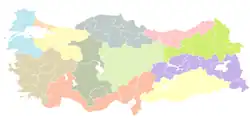
 Location of the province within Turkey | |
| Country | Turkey |
| Seat | Malatya |
| Government | |
| • Mayor | Sami Er (AKP) |
| • Vali | Ersin Yazıcı |
Area | 12,259 km2 (4,733 sq mi) |
| Population (2022)[1] | 812,580 |
| • Density | 66/km2 (170/sq mi) |
| Time zone | UTC+3 (TRT) |
| Area code | 0422 |
| Website | www www |
Malatya Province (Turkish: Malatya ili) is a province and metropolitan municipality of Turkey. Its area is 12,259 km2,[2] and its population is 812,580 (2022).[1] It is part of a larger mountainous area. The capital of the province is the city of Malatya, which has a population of 485,484 (2022).[3]
Districts

Malatya province is divided into 13 districts:
- Akçadağ
- Arapgir
- Arguvan
- Battalgazi
- Darende
- Doğanşehir
- Doğanyol
- Hekimhan
- Kale
- Kuluncak
- Pütürge
- Yazıhan
- Yeşilyurt
ETHNIC STRUCTURE
Malatya is a province characterized by ethnic and sectarian diversity. Both Turks and Kurds live in the city, and the Sunni and Alevi populations coexist closely.
Since Malatya is located in the Eastern Anatolia Region, some people assume that Kurds make up the majority of the population. However, ethnically, Turks are the majority in Malatya. This majority is not by a narrow margin either—Turks form the majority population in all districts except for two.
History
Malatya has been a crossroads and a gateway between Anatolia and the Middle East since ancient times. To the east, the oldest transportation route extends from Malatya through Sivas to Erzurum, and from there to the Caucasus. This route is also known as the Karasu-Aras route. Another important route stretches toward Southeastern Anatolia, reaching Mesopotamia[4] via Malatya and Diyarbakır. From Malatya eastward, the natural routes along the Murat River and the Karasu-Van Lake corridor are among the significant paths.
Another important road comes from the south and converges in Malatya. This route, between Malatya and Kahramanmaraş, runs through a natural corridor formed by valleys flowing in different directions, in a region where the Taurus Mountains are densely situated. Another road, opened through the mountains in the south, connects Urfa to Malatya via Adıyaman.
These mentioned routes converge in Malatya and extend north to the Caucasus, south to Çukurova, Mesopotamia, and Syria, west to the Aegean coast, and east to Iran and the Far East. These routes have been in use since the time of Sargon, the emperor of Akkad. During the Hittite period, this road was also in operation, and it is known that Hittite kings used it to wage wars with other states in Anatolia.
Sources confirm that the Hittite King Šuppiluliuma took this road down to the Lower Euphrates region, thus crossing the Euphrates River near Malatya. It is estimated that this road began in Kayseri-Kültepe, passed through Gürün, Darende, Malatya, and Samsat, and reached Urfa, where it branched into two routes: one toward Carchemish and Aleppo, and the other toward Assyria and Babylon via Nusaybin.
The trade and cultural exchange between Mesopotamia and Anatolia being conducted along this route significantly increased Malatya’s historical and cultural importance.
In addition to the roads used in antiquity, new roads were constructed during the Roman period to facilitate trade and protect borders. Because Malatya served as a major military center, the Romans routed their military and commercial roads through Malatya. This is confirmed by milestone stones erected along the roads. The Byzantine Empire used these Roman roads for similar purposes. During their raids on Byzantine lands, the Arabs utilized the pass between Commagene and Malatya while retreating. The Turks crossed the Euphrates River near Malatya to reach Central Anatolia.
Geography

Local sites
- İnönü University (since 1975)
- Turgut Özal Medical Center (in İnönü University)
- Malatya Erhaç Airport (serving both public and military)
- Eskimalatya (old city centre, historical place)
Bibliography
- Dündar, Fuat (2000), Türkiye nüfus sayımlarında azınlıklar (in Turkish), ISBN 9789758086771
References
- ^ a b "Address-based population registration system (ADNKS) results dated 31 December 2022, Favorite Reports" (XLS). TÜİK. Retrieved 19 September 2023.
- ^ "İl ve İlçe Yüz ölçümleri". General Directorate of Mapping. Retrieved 19 September 2023.
- ^ "Malatya". citypopulation.de. Retrieved 23 January 2024.
- ^ "Mezopotamya", Vikipedi (in Turkish), 2025-05-13, retrieved 2025-08-03
External links
- (in Turkish) Malatya governor's official website
- (in Turkish) Malatya
- (in Turkish) Malatya municipality's official website
- (in English) Malatya weather forecast information
- (in English) Malatya directory
- (in Turkish) Malatya Rent A Car
of Turkey | |||||||||||||||||||||||||||
|---|---|---|---|---|---|---|---|---|---|---|---|---|---|---|---|---|---|---|---|---|---|---|---|---|---|---|---|
| Districts |
|   | |||||||||||||||||||||||||
||
Metropolitan municipalities are bolded. | |||||||||||||||||||||||||||