Angut-e Sharqi Rural District
Angut-e Sharqi Rural District
Persian: دهستان انگوت شرقي | |
|---|---|
Rural District | |
 Angut-e Sharqi Rural District | |
| Coordinates: 39°04′N 47°49′E / 39.067°N 47.817°E[1][2] | |
| Country | Iran |
| Province | Ardabil |
| County | Ungut |
| District | Central |
| Established | 1987[3] |
| Capital | Mohammad Taqi Kandi |
| Population (2016)[4] | |
• Total | 6,969 |
| Time zone | UTC+3:30 (IRST) |
Angut-e Sharqi Rural District (Persian: دهستان انگوت شرقي) is in the Central District[a] of Ungut County, Ardabil province, Iran. Its capital is the village of Mohammad Taqi Kandi.[5] The previous capital of the rural district was the village of Tazeh Kand-e Angut,[3] now the city of Angut.[5]
Demographics
Population
At the time of the 2006 National Census, the rural district's population (as a part of Ungut District[b] in Germi County[c]) was 9,532 in 1,922 households.[6] There were 8,207 inhabitants in 1,967 households at the following census of 2011.[7] The 2016 census measured the population of the rural district as 6,969 in 2,068 households. The most populous of its 54 villages was Garmi Angut, with 491 people.[4]
In 2019, the district was separated from the county in the establishment of Ungut County and renamed the Central District.[5]
Other villages in the rural district
- Abbas Alilu
- Ahad Beyglu
- Arzanaq
- Asghar Khanlu
- Borun Qeshlaq-e Olya
- Borun Qeshlaq-e Sofla
- Chenar
- Dargahlu
- Darreh Gahlui-ye Barzand
- Dash Bolagh-e Barzand
- Dash Qapu
- Hadilu
- Hoseyn Khanlu
- Jabilu
- Jahangirlu
- Jeda
- Kahel Qeshlaq
- Khan Mohammadlu
- Khanali Darrehsi
- Kuramalu
- Mansurlu
- Marallui-ye Kalbalu
- Marallui-ye Jafarqoli Khanlu
- Mohammad Qoli Beyglu
- Mollalu
- Nariman
- Oruj Alilu
- Owch Bolagh
- Panjeh Ali Kharabehsi
- Pirlu
- Qabaleh Kandi
- Qatar-e Olya
- Qatar-e Sofla
- Qeshlaq-e Bakhshali
- Qeshlaq-e Jeda
- Qilulu
- Qorbanlu
- Sarilar
- Seyyedabad
- Shabanlu
- Shaerlu
- Shahbazlu
- Shur Daraq-e Olya
- Shur Daraq-e Sofla
- Tak Bolagh-e Angut
- Tak Dam-e Barzand
- Takahchi
- Tapalqa
- Yelsui
See also
![]() Iran portal
Iran portal
Notes
- ^ Formerly Ungut District of Germi County[5]
- ^ Renamed the Central District of Ungut County[5]
- ^ Formerly Moghan County
References
- ^ OpenStreetMap contributors (3 June 2025). "Tazeh Kand-e Angut, دهستان انگوت شرقی [Angut-e Sharqi Rural District], Central District of Ungut County, Ungut County, Ardabil Province, Iran" (Map). OpenStreetMap (in Persian). Retrieved 3 June 2025.
- ^ "3R88+MM7 Shordara, Ardabil Province, Iran" (Map). Google Maps. Retrieved 21 August 2025.
- ^ a b Mousavi, Mir-Hossein (9 August 1987) [تاریخ تصویب (Approval date) 1366/05/18 (Iranian Jalali calendar)]. ایجاد و تشکیل تعداد 13 دهستان شامل روستاها، مزارع و مکانها در شهرستان مغان تابع استان آذربایجان شرقی [Creation and formation of 13 rural districts including villages, farms and places in Moghan County under East Azerbaijan province]. لام تا کام [Lam ta Kam] (in Persian). وزارت کشور [Ministry of the Interior]. هیات وزیران [Council of Ministers]. شناسه [ID] 519A4A8A-9894-4AA8-BDC0-B77F45FBF8F6. شماره دوره [Course number] 66, شماره جلد [Volume number] 13. Archived from the original on 18 June 2025. Retrieved 18 June 2025.
- ^ a b سرشماري عمومي نفوس و مسكن 1395 : استان اردبیل [General Population and Housing Census 2016: Ardabil Province]. مرکز آمار ایران [Statistical Centre of Iran] (in Persian). Archived from the original (Excel) on 22 March 2019. Retrieved 19 June 2025.
- ^ a b c d e Jahangiri, Eshaq (26 February 2019) [تاریخ ابلاغ (Notification date) 1397/12/07 (Iranian Jalali calendar)]. تصویب نامه در خصوص تقسیمات کشوری در شهرستانهای جم، کنگان در استان بوشهر [Approval letter regarding national divisions in Germi County of Ardabil province]. مرکز پژوهشهای مجلس شورای اسلامی ایران [Research Center of the Islamic Consultative Assembly of Iran] (in Persian). وزارت کشور [Ministry of the Interior]. هیات وزیران [Council of Ministers]. شماره ابلاغیه : ۱۶۴۱۸۲/ت۵۵۷۴۱ه [Notification Number: 164182/T55741H. Archived from the original on 24 June 2021. Retrieved 19 June 2025.
- ^ سرشماري عمومي نفوس و مسكن 1385 : استان اردبیل [General Population and Housing Census 2006: Ardabil Province]. مرکز آمار ایران [Statistical Centre of Iran] (in Persian). Archived from the original (Excel) on 20 September 2011. Retrieved 19 June 2025.
- ^ سرشماري عمومي نفوس و مسكن 1390 : استان اردبیل [General Population and Housing Census 2011: Ardabil Province]. Iran Data Portal—Syracuse University (in Persian). مرکز آمار ایران [Statistical Centre of Iran]. Archived from the original (Excel) on 15 January 2023. Retrieved 19 June 2025.
| Capital | 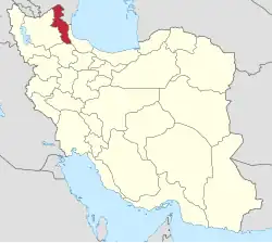 | ||||||||||||||||||||||
|---|---|---|---|---|---|---|---|---|---|---|---|---|---|---|---|---|---|---|---|---|---|---|---|
| Counties and cities |
| ||||||||||||||||||||||
| Landmarks |
| ||||||||||||||||||||||
| Places |
| ||||||||||||||||||||||