Chol Qeshlaqi
Chol Qeshlaqi
Persian: چل قشلاقي | |
|---|---|
Village | |
 Chol Qeshlaqi | |
| Coordinates: 38°30′37″N 47°19′05″E / 38.51028°N 47.31806°E[1] | |
| Country | Iran |
| Province | East Azerbaijan |
| County | Ahar |
| District | Fandoqlu |
| Rural District | Qeshlaq |
| Population (2016)[2] | |
• Total | 844 |
| Time zone | UTC+3:30 (IRST) |
Chol Qeshlaqi (Persian: چل قشلاقي)[a] is a village in Qeshlaq Rural District[4] of Fandoqlu District in Ahar County, East Azerbaijan province, Iran.
Demographics
Population
At the time of the 2006 National Census, the village's population was 973 in 197 households, when it was in the Central District.[5] The following census in 2011 counted 879 people in 243 households.[6] The 2016 census measured the population of the village as 844 people in 273 households.[2]
In 2018, the rural district was separated from the district in the formation of Fandoqlu District.[7]
See also
![]() Iran portal
Iran portal
Notes
References
- ^ OpenStreetMap contributors (12 March 2025). "چل قشلاقی, دهستان قشلاق, بخش مرکزی [Chol Qeshlaqi, Qeshlaq Rural District, Central District], Ahar County, Iran" (Map). OpenStreetMap (in Persian). Retrieved 12 March 2025.
- ^ a b سرشماري عمومي نفوس و مسكن 1395 : استان آذربایجان شرقی [General Population and Housing Census 2016: East Azerbaijan Province]. مرکز آمار ایران [Statistical Centre of Iran] (in Persian). Archived from the original (Excel) on 13 November 2020. Retrieved 19 December 2022.
- ^ Chol Qeshlaqi can be found at GEOnet Names Server, at this link, by opening the Advanced Search box, entering "-3058892" in the "Unique Feature Id" form, and clicking on "Search Database".
- ^ Mousavi, Mir-Hossein (9 August 1987) [تاریخ تصویب (Approval date) 1366/05/18 (Iranian Jalali calendar)]. ایجاد و تشکیل تعداد 30 دهستان شامل روستاها، مزارع و مکانها در شهرستان اهر تابع استان آذربایجان شرقی [Creation and formation of 30 rural districts including villages, farms and places in Ahar County under East Azerbaijan province]. لام تا کام [Lam ta Kam] (in Persian). وزارت کشور [Ministry of the Interior]. هیات وزیران [Council of Ministers]. شناسه [ID] 1F7402E2-5CAC-4D1B-B0FF-D19D6D096C79. شماره دوره [Course number] 66, شماره جلد [Volume number] 11. Archived from the original on 19 June 2025. Retrieved 19 June 2025.
- ^ سرشماري عمومي نفوس و مسكن 1385 : استان آذربایجان شرقی [General Population and Housing Census 2006: East Azerbaijan Province]. مرکز آمار ایران [Statistical Centre of Iran] (in Persian). Archived from the original (Excel) on 20 September 2011. Retrieved 25 September 2022.
- ^ سرشماري عمومي نفوس و مسكن 1390 : استان آذربایجان شرقی [General Population and Housing Census 2011: East Azerbaijan Province]. Iran Data Portal—Syracuse University (in Persian). مرکز آمار ایران [Statistical Centre of Iran]. Archived from the original (Excel) on 16 January 2023. Retrieved 19 December 2022.
- ^ Jahangiri, Eshaq (4 November 2018) [تاریخ تصویب : 1397/08/13 (Date of Approval: 1397/08/13) (Iranian Jalali calendar)]. تصویب نامه درخصوص اصلاحات و تغییرات تقسیماتی در استان آذربایجان شرقی [Resolution on divisional reforms and changes in East Azerbaijan province]. مرکز پژوهشهای مجلس شورای اسلامی ایران [Research Center of the Islamic Consultative Assembly of Iran] (in Persian). وزارت کشور [Ministry of the Interior]. هیات وزیران [Council of Ministers]. پیشنهاد شماره ۱۳۶۱۳۰ [Proposal Number 136130]. Archived from the original on 6 October 2021. Retrieved 4 September 2025.
| Capital | 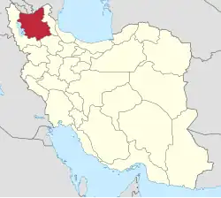 | ||||||||||||||||||||||||||||||||||||||||
|---|---|---|---|---|---|---|---|---|---|---|---|---|---|---|---|---|---|---|---|---|---|---|---|---|---|---|---|---|---|---|---|---|---|---|---|---|---|---|---|---|---|
| Counties and cities |
| ||||||||||||||||||||||||||||||||||||||||
| Landmarks and Sights |
| ||||||||||||||||||||||||||||||||||||||||
| Places |
| ||||||||||||||||||||||||||||||||||||||||