Kah Kesh
Kah Kesh
Persian: كاهكش | |
|---|---|
Village | |
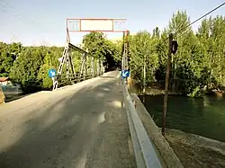 Bridge at Kah Kesh | |
 Kah Kesh | |
| Coordinates: 32°28′25″N 50°56′23″E / 32.47361°N 50.93972°E[1] | |
| Country | Iran |
| Province | Chaharmahal and Bakhtiari |
| County | Saman |
| District | Central |
| Rural District | Saman |
| Population (2016)[2] | |
• Total | 749 |
| Time zone | UTC+3:30 (IRST) |
Kah Kesh (Persian: كاهكش)[a] is a village in Saman Rural District[4] of the Central District in Saman County, Chaharmahal and Bakhtiari province, Iran.
Demographics
Ethnicity
The village is populated by Turkic people.[5]
Population
At the time of the 2006 National Census, the village's population was 773 in 206 households, when it was in the former Saman District of Shahrekord County.[6] The following census in 2011 counted 764 people in 225 households.[7] The 2016 census measured the population of the village as 749 people in 248 households,[2] by which time the district had been separated from the county in the establishment of Saman County. The rural district was transferred to the new Central District.[8]
See also
![]() Iran portal
Iran portal
Notes
References
- ^ OpenStreetMap contributors (11 March 2025). "Kahkash, Saman Village, بخش مرکزی [Central District], Saman County, Chaharmahal and Bakhtiyari Province, Iran" (Map). OpenStreetMap (in Persian). Retrieved 11 March 2025.
- ^ a b سرشماري عمومي نفوس و مسكن 1395 : استان چهارمحال و بختیاری [General Population and Housing Census 2016: Chaharmahal and Bakhtiari Province]. مرکز آمار ایران [Statistical Centre of Iran] (in Persian). Archived from the original (Excel) on 24 May 2019. Retrieved 19 December 2022.
- ^ Kah Kesh can be found at GEOnet Names Server, at this link, by opening the Advanced Search box, entering "-3068440" in the "Unique Feature Id" form, and clicking on "Search Database".
- ^ Mousavi, Mir-Hossein (22 April 1987) [تاریخ تصویب (Approval date) 1366/02/02 (Iranian Jalali calendar)]. ایجاد و تشکیل 8 دهستان شامل روستاها، مزارع و مکانها در شهرستان شهر کرد تابع استان چهار محال و بختیاری [Establishment and formation of eight rural districts including villages, farms and places in Shahrekord County, subordinate to Chaharmahal and Bakhtiari province]. لام تا کام [Lam ta Kam] (in Persian). وزارت کشور [Ministry of the Interior]. هیات وزیران [Council of Ministers]. شناسه [ID] F68A8916-FE1F-44E6-BFC7-A1FE16374F3A. شماره دوره [Course number] 66. Archived from the original on 27 August 2025. Retrieved 27 August 2025.
- ^ "Language distribution: Chahar Mahal va Bakhtiari Province". Iran Atlas. Retrieved 25 March 2021.
- ^ سرشماري عمومي نفوس و مسكن 1385 : استان چهارمحال و بختیاری [General Population and Housing Census 2006: Chaharmahal and Bakhtiari Province]. مرکز آمار ایران [Statistical Centre of Iran] (in Persian). Archived from the original (Excel) on 20 September 2011. Retrieved 25 September 2022.
- ^ سرشماري عمومي نفوس و مسكن 1390 : استان چهارمحال و بختیاری [General Population and Housing Census 2011: Chaharmahal and Bakhtiari Province]. Iran Data Portal—Syracuse University (in Persian). مرکز آمار ایران [Statistical Centre of Iran]. Archived from the original (Excel) on 16 January 2023. Retrieved 19 December 2022.
- ^ Rahimi, Mohammad Reza (1 January 2013) [تاریخ ابلاغیه : 1391/10/12 (Date of Resolution: 1391/10/12) (Iranian Jalali calendar)]. تصویبنامه درخصوص تقسیمات کشوری در استان چهارمحال و بختیاری [Resolution on national divisions in Chaharmahal and Bakhtiari province]. مرکز پژوهشهای مجلس شورای اسلامی ایران [Research Center of the Islamic Consultative Assembly of Iran] (in Persian). وزارت کشور [Ministry of the Interior]. هیات وزیران [Council of Ministers]. بختیاری شماره۲۰۰۶۷۱/ت۴۷۶۶۱ه [Notification Number 200671/T47661H]. Archived from the original on 10 January 2013. Retrieved 27 August 2025.
Chaharmahal and Bakhtiari province, Iran | |||||||||||||||||||||||
|---|---|---|---|---|---|---|---|---|---|---|---|---|---|---|---|---|---|---|---|---|---|---|---|
| Capital |
|  | |||||||||||||||||||||
| Counties and cities |
| ||||||||||||||||||||||
| Landmarks |
| ||||||||||||||||||||||
| populated places |
| ||||||||||||||||||||||