Reefs Harbour-Shoal Cove West-New Ferolle is a local service district and designated place in the Canadian province of Newfoundland and Labrador. It is southwest of Anchor Point.
Geography
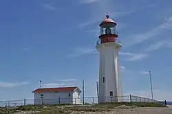
Reefs Harbour-Shoal Cove West-New Ferolle is in Newfoundland within Subdivision C of Division No. 9.[3] The area consists of three unincorporated communities – Reefs Harbour, Shoal Cove and New Ferolle – on the New Ferolle Peninsula near Port au Choix.
Demographics
As a designated place in the 2016 Census of Population conducted by Statistics Canada, Reefs Harbour-Shoal Cove West-New Ferolle recorded a population of 100 living in 53 of its 67 total private dwellings, a change of -56.5% from its 2011 population of 230. With a land area of 11.94 km2 (4.61 sq mi), it had a population density of 8.4/km2 (21.7/sq mi) in 2016.[4]
Government
Reefs Harbour-Shoal Cove West-New Ferolle is a local service district (LSD)[5] that is governed by a committee responsible for the provision of certain services to the community.[6] The chair of the LSD committee is Gloria Tucker.[5]
See also
References
- ^ Rowlett, Russ. "Lighthouses of Canada: Southwestern Newfoundland". The Lighthouse Directory. University of North Carolina at Chapel Hill. Retrieved 2017-02-16.
- ^ List of Lights, Pub. 110: Greenland, The East Coasts of North and South America (Excluding Continental U.S.A. Except the East Coast of Florida) and the West Indies (PDF). List of Lights. United States National Geospatial-Intelligence Agency. 2016.
- ^ "Population and dwelling counts, for Canada, provinces and territories, census divisions, census subdivisions (municipalities) and designated places, 2016 and 2011 censuses – 100% data (Newfoundland and Labrador)". Statistics Canada. February 7, 2018. Retrieved December 23, 2021.
- ^ "Population and dwelling counts, for Canada, provinces and territories, and designated places, 2016 and 2011 censuses – 100% data (Newfoundland and Labrador)". Statistics Canada. February 7, 2018. Retrieved December 22, 2021.
- ^ a b "Directory of Local Service Districts" (PDF). Government of Newfoundland and Labrador. October 2021. Retrieved January 1, 2022.
- ^ "Local Service Districts – Frequently Asked Questions". Government of Newfoundland and Labrador. Retrieved January 1, 2022.
External links
51°01′09″N 57°02′21″W / 51.0193°N 57.0392°W / 51.0193; -57.0392
|
|---|
| Towns | | |
|---|
Unorganized
subdivisions | |
|---|
Designated
places |
- Bartletts Harbour
- Bear Cove, Northern Peninsula
- Black Duck Cove, Northern Peninsula
- Brig Bay
- Castor River North
- Castor River South
- Croque
- Eddies Cove West
- Forresters Point
- Great Brehat
- Green Island Brook
- L'Anse aux Meadows to Quirpon
- Nameless Cove
- Pidgeon Cove-St. Barbe
- Plum Point
- Portland Creek
- Reefs Harbour-Shoal Cove West-New Ferolle
- Ship Cove, Northern Peninsula
- St. Anthony Bight
- St. Juliens
|
|---|
|
|
|---|
|
Subdivisions and
statistical units | |
|---|
| Communities | |
|---|
| Cities | |
|---|
Local service
districts (LSDs)
and designated
places (DPLs) | Both LSDs
and DPLs |
- Aspen Cove
- Barachois Brook
- Bartlett's Harbour
- Bay St. George South
- Beaches
- Bear Cove, Northern Peninsula
- Beau Bois
- Bellevue
- Bellevue Beach
- Benoits Siding
- Benton
- Birchy Cove
- Black Duck
- Black Duck Brook and Winterhouse
- Black Duck Cove, Northern Peninsula
- Black Tickle
- Blaketown
- Boyd's Cove
- Bridgeport
- Brig Bay
- Brigus South
- Brown's Arm
- Buchans Junction
- Bunyan's Cove
- Burgoyne's Cove
- Burnside-St. Chads
- Burnt Cove, St. Michael's, Bauline South
- Burnt Point-Gull Island-Northern Bay
- Calvert
- Campbells Creek
- Canning's Cove
- Cape Freels North
- Cape Ray
- Caplin Cove-Southport
- Castor River North
- Castor River South
- Cavendish
- Chanceport
- Charlottetown, Bonavista Bay
- Cobb's Arm
- Cottrell's Cove
- Deadman's Bay
- Deep Bight
- Diamond Cove
- Dildo
- Dunfield
- Eddies Cove West
- Epworth-Great Salmonier
- Fairbanks-Hillgrade
- Fairhaven
- Flat Bay
- Forest Field-New Bridge
- Forresters Point
- Fox Island River-Point au Mal
- Fox Roost-Margaree
- Francois
- Freshwater, Conception Bay
- Gander Bay North
- Gander Bay South
- Garden Cove
- Georgetown
- Glovers Harbour
- Goobies
- Grates Cove
- Great Brehat
- Great Codroy
- Green Island Brook
- Green's Harbour
- Grey River
- Harbour Mille-Little Harbour East
- Harry's Harbour
- Herring Neck
- Hickman's Harbour-Robinson Bight
- Hodge's Cove
- Hopeall
- Horwood
- Indian Cove
- Jackson's Cove-Langdon's Cove-Silverdale
- Jean de Baie
- La Poile
- Lance Cove, Bell Island
- L'Anse aux Meadows to Quirpon
- Laurenceton
- Little Harbour (East), Placentia Bay
- Little Rapids
- Little St. Lawrence
- Lodge Bay
- Loon Bay
- Lower Lance Cove
- Main Point-Davidsville
- Mainland
- Makinsons
- Markland
- Marysvale
- Mattis Point
- McCallum
- Merritt's Harbour
- Mobile
- Moreton's Harbour
- Nameless Cove
- New Chelsea-New Melbourne-Brownsdale-Sibley's Cove-Lead Cove
- New Harbour, Trinity Bay
- Newman's Cove
- Newville
- Noggin Cove
- Norman's Bay
- Norris Arm North
- North Harbour, St. Mary's Bay
- O'Donnells
- Old Shop
- Open Hall-Red Cliffe
- O'Regan's Central
- Patrick's Cove-Angels Cove
- Pensons Arm
- Petit Forte
- Petley
- Phillips Head
- Piccadilly Head
- Piccadilly Slant-Abraham's Cove
- Pidgeon Cove-St. Barbe
- Pleasantview
- Plum Point
- Pollard's Point
- Port Albert
- Portland Creek
- Purcell's Harbour
- Pynns Brook
- Random Island West
- Random Sound West
- Rattling Brook
- Roaches Line
- Rock Harbour
- Searston
- Sheaves Cove
- Sheppardville
- Ship Cove, Northern Peninsula
- Ship Cove-Lower Cove-Jerry's Nose
- Smith's Harbour
- Smith's Sound
- Sop's Arm
- South Dildo
- South East Bight
- Spanish Room
- Spillars Cove
- St Andrews
- St. Anthony Bight
- St. Joseph's Cove-St. Veronica's
- St. Judes
- St Patricks
- St. Teresa
- Stanhope
- Stoneville
- Summerville-Princeton-Southern Bay
- Swift Current
- Thornlea
- Three Rock Cove
- Tizzard's Harbour
- Tompkins
- Tors Cove
- Upper Amherst Cove
- Upper Ferry
- Valley Pond
- Virgin Arm-Carter's Cove
- West Bay
- Wild Cove, White Bay
- William's Harbour
|
|---|
| LSDs only |
- Biscay Bay
- Deer Park/Vineland Road
- Hay Cove
- Lethbridge to Sweet Bay
- Noddy Bay
- Quirpon
- Shoe Cove (Notre Dame Bay)
- Straitsview
|
|---|
| DPLs only |
- Bloomfield
- Brigus Junction
- Britannia
- Capstan Island
- Champneys-English Harbour
- Croque
- Deep Bay
- Fortune Harbour
- Frederickton
- Gambo
- George's Brook
- Goulds
- Grand Beach
- Grand Bruit
- Harbour Round
- Humber Village
- Island Harbour
- Knights Cove - Stock Cove
- Ladle Cove
- Michael's Harbour
- Millville to Cape Anguille
- Milton
- Musgrave Harbour
- Northwest Brook-Ivany's Cove-Queens Cove
- Sheshatshiu
- Snook's Arm
- St. Juliens
- Stag Harbour
- Stephenville Crossing
- Trinity East
|
|---|
|
|---|
 Category:Newfoundland and Labrador Category:Newfoundland and Labrador Portal:Canada Portal:Canada WikiProject:Newfoundland and Labrador WikiProject:Newfoundland and Labrador
|
Lighthouses of Canada |
|---|
| British Columbia |
- Amphitrite Point
- Ballenas Island
- Boat Bluff
- Brockton Point
- Cape Beale
- Cape Mudge
- Cape Scott
- Carmanah Point
- Chrome Island
- Discovery Island
- Entrance Island
- Estevan Point
- Fisgard
- Langara
- Pachena Point
- Point Atkinson
- Race Rocks
- Sheringham Point
- Trial Islands
- Triple Island
|
|---|
| Manitoba |
- George Island
- Warren Landing Lower Range
- Warren Landing Upper Range
|
|---|
| New Brunswick | |
|---|
| Newfoundland and Labrador | |
|---|
| Nova Scotia | |
|---|
| Ontario | |
|---|
| Prince Edward Island |
- Annandale Range
- Big Tignish
- Brighton Beach
- Cape Tryon
- Cascumpeque
- Haszard Point
- Leards Range
- Little Channel Range
- Malpeque Harbour
- Malpeque Outer Range
- Miminegash Range
- Murray Harbour
- North Cape
- North Rustico Harbour
- Northport Range
- Point Prim
- Seacow Head
- St. Peters Harbour
- Summerside Outer Range
- Warren Cove Range
- Wood Islands
- Wrights Range
|
|---|
| Quebec | |
|---|
.svg.png) Canada portal |
| Authority control databases: New Ferrolle Peninsula light | |
|---|