List of mountain peaks of Arizona
This article comprises three sortable tables of major mountain peaks[1] of the U.S. State of Arizona.
The summit of a mountain or hill may be measured in three principal ways:
- The topographic elevation of a summit measures the height of the summit above a geodetic sea level.[2][3] The first table below ranks the 20 highest major summits of Arizona by elevation.
- The topographic prominence of a summit is a measure of how high the summit rises above its surroundings.[4][3] The second table below ranks the 20 most prominent summits of Arizona.
- The topographic isolation (or radius of dominance) of a summit measures how far the summit lies from its nearest point of equal elevation.[5] The third table below ranks the 20 most isolated major summits of Arizona.
Highest major summits
Of the highest major summits of Arizona, Humphreys Peak exceeds 3500 meters (11,483 feet) of elevation, five peaks exceed 3000 meters (9843 feet), and 14 peaks exceed 2500 meters (8202 feet) of elevation.
| Rank | Mountain peak | Mountain range | Elevation | Prominence | Isolation | Location |
|---|---|---|---|---|---|---|
| 1 | Humphreys Peak[6][7][8][a][b] | San Francisco Peaks | 12,637 ft 3852 m |
6,039 ft 1841 m |
246 mi 396 km |
35°20′47″N 111°40′41″W / 35.3464°N 111.6780°W |
| 2 | Baldy Peak[9][10][11][12][c] | White Mountains | 11,409 ft 3477.4 m |
4,728 ft 1441 m |
154 mi 248 km |
33°54′21″N 109°33′45″W / 33.9059°N 109.5626°W |
| 3 | Escudilla Mountain[13][14][15][16] | White Mountains | 10,886 ft 3318 m |
2,382 ft 726 m |
24.6 mi 39.6 km |
33°56′50″N 109°07′18″W / 33.9473°N 109.1217°W |
| 4 | Mount Graham[17][18][19][20][d] | Pinaleño Mountains | 10,724 ft 3268.6 m |
6,340 ft 1932 m |
82.4 mi 132.6 km |
32°42′06″N 109°52′17″W / 32.7017°N 109.8714°W |
| 5 | Kendrick Peak[21][22][23][24] | Colorado Plateau | 10,425 ft 3177.4 m |
2,488 ft 758 m |
10.66 mi 17.15 km |
35°24′29″N 111°51′04″W / 35.4081°N 111.8510°W |
| 6 | Roof Butte[25][26][27][28][e] | Chuska Mountains | 9,787 ft 2983.1 m |
3,170 ft 966 m |
59.3 mi 95.5 km |
36°27′37″N 109°05′35″W / 36.4602°N 109.0931°W |
| 7 | Chiricahua Peak[29][30][31][f][g] | Chiricahua Mountains | 9,763 ft 2976 m |
5,149 ft 1569 m |
64.2 mi 103.3 km |
31°50′44″N 109°17′28″W / 31.8456°N 109.2910°W |
| 8 | Miller Peak[32][33][34][h][i] | Huachuca Mountains | 9,470 ft 2886 m |
5,011 ft 1527 m |
66.5 mi 107 km |
31°23′34″N 110°17′35″W / 31.3928°N 110.2930°W |
| 9 | Mount Wrightson[35][36][37][j][k] | Santa Rita Mountains | 9,457 ft 2882 m |
4,591 ft 1399 m |
38.8 mi 62.5 km |
31°41′45″N 110°50′54″W / 31.6959°N 110.8482°W |
| 10 | Kaibab Plateau high point[38][39][l] | Kaibab Plateau | 9,224 ft 2812 m |
3,610 ft 1100 m |
69.1 mi 111.2 km |
36°23′45″N 112°09′03″W / 36.3958°N 112.1509°W |
| 11 | Mount Lemmon[40][41][42][m][n] | Santa Catalina Mountains | 9,160 ft 2792 m |
5,177 ft 1578 m |
51.5 mi 82.9 km |
32°26′35″N 110°47′19″W / 32.4430°N 110.7885°W |
| 12 | Mica Mountain[43][44][45][o][p] | Rincon Mountains | 8,667 ft 2642 m |
4,608 ft 1405 m |
20.6 mi 33.2 km |
32°13′12″N 110°32′37″W / 32.2199°N 110.5435°W |
| 13 | Hualapai Peak[46][47][48][49][q] | Hualapai Mountains | 8,426 ft 2568.2 m |
4,439 ft 1353 m |
95.2 mi 153.2 km |
35°04′30″N 113°53′52″W / 35.0751°N 113.8979°W |
| 14 | Mount Turnbull[50][51][52][r][s] | Santa Teresa Mountains | 8,284 ft 2525 m |
3,582 ft 1092 m |
25.7 mi 41.4 km |
33°04′27″N 110°15′40″W / 33.0741°N 110.2610°W |
| 15 | Black Mesa high point[53][54][t] | Black Mesa | 8,171 ft 2491 m |
1,818 ft 554 m |
41 mi 66 km |
36°39′05″N 110°15′47″W / 36.6514°N 110.2630°W |
| 16 | Mount Trumbull[55][56][57][58][u] | Unikaret Plateau | 8,038 ft 2449.9 m |
2,974 ft 906 m |
45.9 mi 73.8 km |
36°24′36″N 113°08′19″W / 36.4101°N 113.1385°W |
| 17 | Mount Union[59][60][61][62][v] | Bradshaw Mountains | 7,986 ft 2434.2 m |
2,949 ft 899 m |
54.4 mi 87.5 km |
34°24′54″N 112°24′16″W / 34.4150°N 112.4045°W |
| 18 | Mazatzal Peak[63][64][65][66][w] | Mazatzal Mountains | 7,908 ft 2410.4 m |
3,963 ft 1208 m |
27.2 mi 43.7 km |
34°03′45″N 111°27′41″W / 34.0626°N 111.4615°W |
| 19 | Pinal Peak[67][68][69][x][y] | Pinal Mountains | 7,853 ft 2393 m |
4,110 ft 1253 m |
35.1 mi 56.4 km |
33°16′57″N 110°49′17″W / 33.2824°N 110.8213°W |
| 20 | Aztec Peak[70][71][72][z][aa] | Sierra Ancha | 7,751 ft 2362 m |
2,488 ft 758 m |
35.9 mi 57.8 km |
33°48′44″N 110°54′28″W / 33.8122°N 110.9079°W |
Most prominent summits
Of the most prominent summits of Arizona, five peaks are ultra-prominent summits with more than 1500 meters (4921 feet) of topographic prominence and 18 peaks exceed 1000 meters (3281 feet) of topographic prominence.
| Rank | Mountain peak | Mountain range | Elevation | Prominence | Isolation | Location |
|---|---|---|---|---|---|---|
| 1 | Mount Graham[17][18][19][20][d] | Pinaleño Mountains | 10,724 ft 3268.6 m |
6,340 ft 1932 m |
82.4 mi 132.6 km |
32°42′06″N 109°52′17″W / 32.7017°N 109.8714°W |
| 2 | Humphreys Peak[6][7][8][a][b] | San Francisco Peaks | 12,637 ft 3852 m |
6,039 ft 1841 m |
246 mi 396 km |
35°20′47″N 111°40′41″W / 35.3464°N 111.6780°W |
| 3 | Mount Lemmon[40][41][42][m][n] | Santa Catalina Mountains | 9,160 ft 2792 m |
5,177 ft 1578 m |
51.5 mi 82.9 km |
32°26′35″N 110°47′19″W / 32.4430°N 110.7885°W |
| 4 | Chiricahua Peak[29][30][31][f][g] | Chiricahua Mountains | 9,763 ft 2976 m |
5,149 ft 1569 m |
64.2 mi 103.3 km |
31°50′44″N 109°17′28″W / 31.8456°N 109.2910°W |
| 5 | Miller Peak[32][33][34][h][i] | Huachuca Mountains | 9,470 ft 2886 m |
5,011 ft 1527 m |
66.5 mi 107 km |
31°23′34″N 110°17′35″W / 31.3928°N 110.2930°W |
| 6 | Baldy Peak[9][10][11][12][c] | White Mountains | 11,409 ft 3477.4 m |
4,728 ft 1441 m |
154 mi 248 km |
33°54′21″N 109°33′45″W / 33.9059°N 109.5626°W |
| 7 | Mica Mountain[43][44][45][o][p] | Rincon Mountains | 8,667 ft 2642 m |
4,608 ft 1405 m |
20.6 mi 33.2 km |
32°13′12″N 110°32′37″W / 32.2199°N 110.5435°W |
| 8 | Mount Wrightson[35][36][37][j][k] | Santa Rita Mountains | 9,457 ft 2882 m |
4,591 ft 1399 m |
38.8 mi 62.5 km |
31°41′45″N 110°50′54″W / 31.6959°N 110.8482°W |
| 9 | Hualapai Peak[46][47][48][49][q] | Hualapai Mountains | 8,426 ft 2568.2 m |
4,439 ft 1353 m |
95.2 mi 153.2 km |
35°04′30″N 113°53′52″W / 35.0751°N 113.8979°W |
| 10 | Baboquivari Peak[73][74][75][ab][ac] | Baboquivari Mountains | 7,737 ft 2358 m |
4,204 ft 1281 m |
42 mi 67.5 km |
31°46′16″N 111°35′45″W / 31.7710°N 111.5958°W |
| 11 | Pinal Peak[67][68][69][x][y] | Pinal Mountains | 7,853 ft 2393 m |
4,110 ft 1253 m |
35.1 mi 56.4 km |
33°16′57″N 110°49′17″W / 33.2824°N 110.8213°W |
| 12 | Mazatzal Peak[63][64][65][66][w] | Mazatzal Mountains | 7,908 ft 2410.4 m |
3,963 ft 1208 m |
27.2 mi 43.7 km |
34°03′45″N 111°27′41″W / 34.0626°N 111.4615°W |
| 13 | Mount Tipton[76][77][78][ad] | Cerbat Mountains | 7,153 ft 2180.2 m |
3,638 ft 1109 m |
33.8 mi 54.5 km |
35°32′20″N 114°11′34″W / 35.5389°N 114.1927°W |
| 14 | Kaibab Plateau high point[38][39][l] | Kaibab Plateau | 9,224 ft 2812 m |
3,610 ft 1100 m |
69.1 mi 111.2 km |
36°23′45″N 112°09′03″W / 36.3958°N 112.1509°W |
| 15 | Mount Turnbull[50][51][52][r][s] | Santa Teresa Mountains | 8,284 ft 2525 m |
3,582 ft 1092 m |
25.7 mi 41.4 km |
33°04′27″N 110°15′40″W / 33.0741°N 110.2610°W |
| 16 | Signal Peak[79][80][81][82][ae] | Kofa Mountains | 4,882 ft 1487.9 m |
3,487 ft 1063 m |
51.8 mi 83.3 km |
33°21′33″N 114°04′58″W / 33.3592°N 114.0829°W |
| 17 | Harquahala Mountain[83][84][af][ag] | Harquahala Mountains | 5,684 ft 1732 m |
3,471 ft 1058 m |
42.9 mi 69 km |
33°48′42″N 113°20′49″W / 33.8118°N 113.3469°W |
| 18 | Browns Peak[85][86][87][88] | Mazatzal Mountains | 7,659 ft 2334.5 m |
3,317 ft 1011 m |
25.6 mi 41.1 km |
33°41′04″N 111°19′33″W / 33.6844°N 111.3257°W |
| 19 | Sierra Estrella high point[89][ah] | Sierra Estrella | 4,514 ft 1376 m |
3,217 ft 981 m |
47.4 mi 76.3 km |
33°16′25″N 112°16′51″W / 33.2735°N 112.2807°W |
| 20 | Roof Butte[25][26][27][28][e] | Chuska Mountains | 9,787 ft 2983.1 m |
3,170 ft 966 m |
59.3 mi 95.5 km |
36°27′37″N 109°05′35″W / 36.4602°N 109.0931°W |
Most isolated major summits
Of the most isolated major summits of Arizona, Humphreys Peak and Baldy Peak exceed 200 kilometers (124.3 miles) of topographic isolation and seven peaks exceed 100 kilometers (62.14 miles) of topographic isolation.
| Rank | Mountain peak | Mountain range | Elevation | Prominence | Isolation | Location |
|---|---|---|---|---|---|---|
| 1 | Humphreys Peak[6][7][8][a][b] | San Francisco Peaks | 12,637 ft 3852 m |
6,039 ft 1841 m |
246 mi 396 km |
35°20′47″N 111°40′41″W / 35.3464°N 111.6780°W |
| 2 | Baldy Peak[9][10][11][12][c] | White Mountains | 11,409 ft 3477.4 m |
4,728 ft 1441 m |
154 mi 248 km |
33°54′21″N 109°33′45″W / 33.9059°N 109.5626°W |
| 3 | Hualapai Peak[46][47][48][49][q] | Hualapai Mountains | 8,426 ft 2568.2 m |
4,439 ft 1353 m |
95.2 mi 153.2 km |
35°04′30″N 113°53′52″W / 35.0751°N 113.8979°W |
| 4 | Mount Graham[17][18][19][20][d] | Pinaleño Mountains | 10,724 ft 3268.6 m |
6,340 ft 1932 m |
82.4 mi 132.6 km |
32°42′06″N 109°52′17″W / 32.7017°N 109.8714°W |
| 5 | Kaibab Plateau high point[38][39][l] | Kaibab Plateau | 9,224 ft 2812 m |
3,610 ft 1100 m |
69.1 mi 111.2 km |
36°23′45″N 112°09′03″W / 36.3958°N 112.1509°W |
| 6 | Miller Peak[32][33][34][h][i] | Huachuca Mountains | 9,470 ft 2886 m |
5,011 ft 1527 m |
66.5 mi 107 km |
31°23′34″N 110°17′35″W / 31.3928°N 110.2930°W |
| 7 | Chiricahua Peak[29][30][31][f][g] | Chiricahua Mountains | 9,763 ft 2976 m |
5,149 ft 1569 m |
64.2 mi 103.3 km |
31°50′44″N 109°17′28″W / 31.8456°N 109.2910°W |
| 8 | Mount Ajo[90][91][ai] | Ajo Range | 4,811 ft 1466 m |
2,703 ft 824 m |
61.2 mi 98.5 km |
32°01′36″N 112°41′26″W / 32.0268°N 112.6906°W |
| 9 | Roof Butte[25][26][27][28][e] | Chuska Mountains | 9,787 ft 2983.1 m |
3,170 ft 966 m |
59.3 mi 95.5 km |
36°27′37″N 109°05′35″W / 36.4602°N 109.0931°W |
| 10 | Mount Union[59][60][61][62][v] | Bradshaw Mountains | 7,986 ft 2434.2 m |
2,949 ft 899 m |
54.4 mi 87.5 km |
34°24′54″N 112°24′16″W / 34.4150°N 112.4045°W |
| 11 | Signal Peak[79][80][81][82][ae] | Kofa Mountains | 4,882 ft 1487.9 m |
3,487 ft 1063 m |
51.8 mi 83.3 km |
33°21′33″N 114°04′58″W / 33.3592°N 114.0829°W |
| 12 | Mount Lemmon[40][41][42][m][n] | Santa Catalina Mountains | 9,160 ft 2792 m |
5,177 ft 1578 m |
51.5 mi 82.9 km |
32°26′35″N 110°47′19″W / 32.4430°N 110.7885°W |
| 13 | Sierra Estrella high point[89][ah] | Sierra Estrella | 4,514 ft 1376 m |
3,217 ft 981 m |
47.4 mi 76.3 km |
33°16′25″N 112°16′51″W / 33.2735°N 112.2807°W |
| 14 | Mount Trumbull[55][56][57][58][u] | Unikaret Plateau | 8,038 ft 2449.9 m |
2,974 ft 906 m |
45.9 mi 73.8 km |
36°24′36″N 113°08′19″W / 36.4101°N 113.1385°W |
| 15 | Harquahala Mountain[83][84][af][ag] | Harquahala Mountains | 5,684 ft 1732 m |
3,471 ft 1058 m |
42.9 mi 69 km |
33°48′42″N 113°20′49″W / 33.8118°N 113.3469°W |
| 16 | Baboquivari Peak[73][74][75][ab][ac] | Baboquivari Mountains | 7,737 ft 2358 m |
4,204 ft 1281 m |
42 mi 67.5 km |
31°46′16″N 111°35′45″W / 31.7710°N 111.5958°W |
| 17 | Black Mesa high point[53][54][t] | Black Mesa | 8,171 ft 2491 m |
1,818 ft 554 m |
41 mi 66 km |
36°39′05″N 110°15′47″W / 36.6514°N 110.2630°W |
| 18 | Mount Wrightson[35][36][37][j][k] | Santa Rita Mountains | 9,457 ft 2882 m |
4,591 ft 1399 m |
38.8 mi 62.5 km |
31°41′45″N 110°50′54″W / 31.6959°N 110.8482°W |
| 19 | Aztec Peak[70][71][72][z][aa] | Sierra Ancha | 7,751 ft 2362 m |
2,488 ft 758 m |
35.9 mi 57.8 km |
33°48′44″N 110°54′28″W / 33.8122°N 110.9079°W |
| 20 | Pinal Peak[67][68][69][x][y] | Pinal Mountains | 7,853 ft 2393 m |
4,110 ft 1253 m |
35.1 mi 56.4 km |
33°16′57″N 110°49′17″W / 33.2824°N 110.8213°W |
Gallery
-
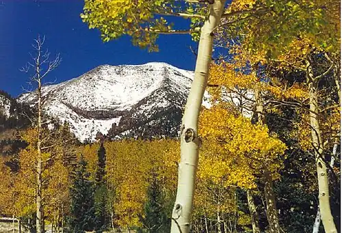
 Humphreys Peak
 -
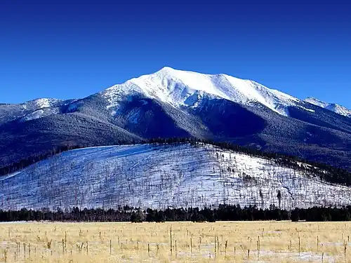
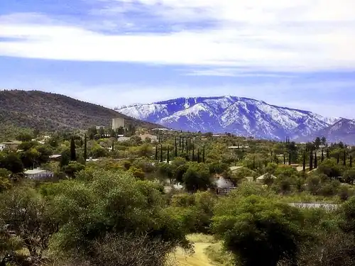
.jpg) Mount Graham
Mount Graham -
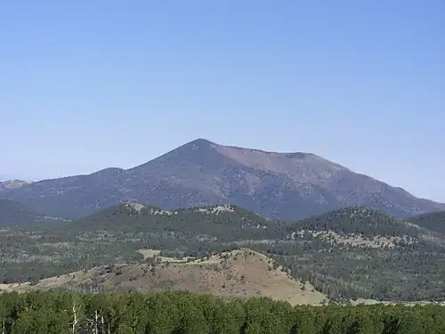 Kendrick Peak
 -
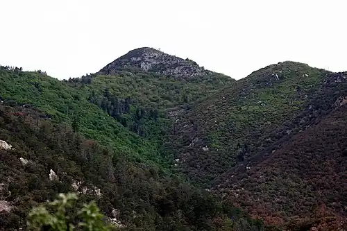 Miller Peak
 -
 Mount Lemmon
 -
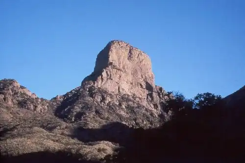 Baboquivari Peak
See also
- List of mountain peaks of North America
- List of mountain peaks of Greenland
- List of mountain peaks of Canada
- List of mountain peaks of the Rocky Mountains
- List of mountain peaks of the United States
- List of mountain peaks of Alaska
- List of mountain peaks of Arizona
- List of mountain peaks of California
- List of mountain peaks of Colorado
- List of mountain peaks of Hawaiʻi
- List of mountain peaks of Idaho
- List of mountain peaks of Montana
- List of mountain peaks of Nevada
- List of mountain peaks of New Mexico
- List of mountain peaks of Oregon
- List of mountain peaks of Utah
- List of mountain peaks of Washington (state)
- List of mountain peaks of Wyoming
- List of mountain peaks of México
- List of mountain peaks of Central America
- List of mountain peaks of the Caribbean
- Arizona
- Geography of Arizona
- Category:Mountains of Arizona
- Geography of Arizona
- Physical geography
- Topography
- Topographic elevation
- Topographic prominence
- Topographic isolation
- Topography
Notes
- ^ a b c The summit of Humphreys Peak is the highest point of the San Francisco Peaks and the U.S. State of Arizona.
- ^ a b c The elevation of Humphreys Peak includes an adjustment of +1.345 m (4.41 ft) from NGVD 29 to NAVD 88.
- ^ a b c The summit of Baldy Peak is the highest point of the White Mountains.
- ^ a b c The summit of Mount Graham is the highest point of the Pinaleño Mountains.
- ^ a b c The summit of Roof Butte is the highest point of the Chuska Mountains.
- ^ a b c The summit of Chiricahua Peak is the highest point of the Chiricahua Mountains.
- ^ a b c The elevation of Chiricahua Peak includes an adjustment of +1.173 m (3.85 ft) from NGVD 29 to NAVD 88.
- ^ a b c The summit of Miller Peak is the highest point of the Huachuca Mountains.
- ^ a b c The elevation of Miller Peak includes an adjustment of +1.067 m (3.5 ft) from NGVD 29 to NAVD 88.
- ^ a b c The summit of Mount Wrightson is the highest point of the Santa Rita Mountains.
- ^ a b c The elevation of Mount Wrightson includes an adjustment of +1.073 m (3.52 ft) from NGVD 29 to NAVD 88.
- ^ a b c The elevation of Kaibab Plateau high point includes an adjustment of +1.301 m (4.27 ft) from NGVD 29 to NAVD 88.
- ^ a b c The summit of Mount Lemmon is the highest point of the Santa Catalina Mountains.
- ^ a b c The elevation of Mount Lemmon includes an adjustment of +1.004 m (3.29 ft) from NGVD 29 to NAVD 88.
- ^ a b The summit of Mica Mountain is the highest point of the Rincon Mountains.
- ^ a b The elevation of Mica Mountain includes an adjustment of +0.96 m (3.15 ft) from NGVD 29 to NAVD 88.
- ^ a b c The summit of Hualapai Peak is the highest point of the Hualapai Mountains.
- ^ a b The summit of Mount Turnbull is the highest point of the Santa Teresa Mountains.
- ^ a b The elevation of Mount Turnbull includes an adjustment of +0.747 m (2.45 ft) from NGVD 29 to NAVD 88.
- ^ a b The summit of Mount Trumbull is the highest point of the Unikaret Plateau.
- ^ a b The summit of Mount Union is the highest point of the Bradshaw Mountains.
- ^ a b The summit of Mazatzal Peak is the highest point of the Mazatzal Mountains.
- ^ a b c The summit of Pinal Peak is the highest point of the Pinal Mountains.
- ^ a b c The elevation of Pinal Peak includes an adjustment of +0.759 m (2.49 ft) from NGVD 29 to NAVD 88.
- ^ a b The summit of Aztec Peak is the highest point of the Sierra Ancha.
- ^ a b The elevation of Aztec Peak includes an adjustment of +0.805 m (2.64 ft) from NGVD 29 to NAVD 88.
- ^ a b The summit of Baboquivari Peak is the highest point of the Baboquivari Mountains.
- ^ a b The elevation of Baboquivari Peak includes an adjustment of +0.864 m (2.83 ft) from NGVD 29 to NAVD 88.
- ^ The summit of Mount Tipton is the highest point of the Cerbat Mountains.
- ^ a b The summit of Signal Peak is the highest point of the Kofa Mountains.
- ^ a b The summit of Harquahala Mountain is the highest point of the Harquahala Mountains.
- ^ a b The elevation of Harquahala Mountain includes an adjustment of +0.768 m (2.52 ft) from NGVD 29 to NAVD 88.
- ^ a b The elevation of Sierra Estrella high point includes an adjustment of +0.657 m (2.16 ft) from NGVD 29 to NAVD 88.
- ^ The elevation of Mount Ajo includes an adjustment of +0.793 m (2.6 ft) from NGVD 29 to NAVD 88.
References
- ^ This article defines a significant summit as a summit with at least 100 meters (328.1 feet) of topographic prominence, and a major summit as a summit with at least 500 meters (1640 feet) of topographic prominence. All summits in this article have at least 500 meters of topographic prominence. An ultra-prominent summit is a summit with at least 1500 meters (4921 feet) of topographic prominence.
- ^ All elevations in this article include an elevation adjustment from the National Geodetic Vertical Datum of 1929 (NGVD 29) to the North American Vertical Datum of 1988 (NAVD 88). For further information, please see this United States National Geodetic Survey note.
- ^ a b If the elevation or prominence of a summit is calculated as a range of values, the arithmetic mean is shown.
- ^ The topographic prominence of a summit is the topographic elevation difference between the summit and its highest or key col to a higher summit. The summit may be near its key col or quite far away. The key col for Denali in Alaska is the Isthmus of Rivas in Nicaragua, 7642 kilometers (4749 miles) away.
- ^ The topographic isolation of a summit is the great-circle distance to its nearest point of equal elevation.
- ^ a b c "Humphreys Peak". Geographic Names Information System. United States Geological Survey, United States Department of the Interior.
- ^ a b c "Humphreys Peak". Peakbagger.com. Retrieved June 14, 2016.
- ^ a b c "Humphreys Peak". Bivouac.com. Retrieved June 14, 2016.
- ^ a b c "BALDY". Datasheet for NGS Station DT0788. U.S. National Geodetic Survey. Retrieved June 14, 2016.
- ^ a b c "Baldy Peak". Geographic Names Information System. United States Geological Survey, United States Department of the Interior.
- ^ a b c "Baldy Peak". Peakbagger.com. Retrieved June 14, 2016.
- ^ a b c "Baldy Peak". Bivouac.com. Retrieved June 14, 2016.
- ^ "ESCUDILLA". Datasheet for NGS Station DT0715. U.S. National Geodetic Survey. Retrieved June 14, 2016.
- ^ "Escudilla Mountain". Geographic Names Information System. United States Geological Survey, United States Department of the Interior.
- ^ "Escudilla Mountain". Peakbagger.com. Retrieved June 14, 2016.
- ^ "Escudilla Mountain". Bivouac.com. Retrieved June 14, 2016.
- ^ a b c "GRAHAM". Datasheet for NGS Station CY1235. U.S. National Geodetic Survey. Retrieved June 14, 2016.
- ^ a b c "Mount Graham". Geographic Names Information System. United States Geological Survey, United States Department of the Interior.
- ^ a b c "Mount Graham". Peakbagger.com. Retrieved June 14, 2016.
- ^ a b c "Mount Graham". Bivouac.com. Retrieved June 14, 2016.
- ^ "KENDRICK". Datasheet for NGS Station FQ0560. U.S. National Geodetic Survey. Retrieved June 14, 2016.
- ^ "Kendrick Peak". Geographic Names Information System. United States Geological Survey, United States Department of the Interior.
- ^ "Kendrick Peak". Peakbagger.com. Retrieved June 14, 2016.
- ^ "Kendrick Peak". Bivouac.com. Retrieved June 14, 2016.
- ^ a b c "ROOF". Datasheet for NGS Station GO0270. U.S. National Geodetic Survey. Retrieved June 14, 2016.
- ^ a b c "Roof Butte". Geographic Names Information System. United States Geological Survey, United States Department of the Interior.
- ^ a b c "Roof Butte". Peakbagger.com. Retrieved June 14, 2016.
- ^ a b c "Roof Butte". Bivouac.com. Retrieved June 14, 2016.
- ^ a b c "Chiricahua Peak". Geographic Names Information System. United States Geological Survey, United States Department of the Interior.
- ^ a b c "Chiricahua Peak". Peakbagger.com. Retrieved June 14, 2016.
- ^ a b c "Chiricahua Peak". Bivouac.com. Retrieved June 14, 2016.
- ^ a b c "Miller Peak". Geographic Names Information System. United States Geological Survey, United States Department of the Interior.
- ^ a b c "Miller Peak". Peakbagger.com. Retrieved June 14, 2016.
- ^ a b c "Miller Peak". Bivouac.com. Retrieved June 14, 2016.
- ^ a b c "Mount Wrightson". Geographic Names Information System. United States Geological Survey, United States Department of the Interior.
- ^ a b c "Mount Wrightson". Peakbagger.com. Retrieved June 14, 2016.
- ^ a b c "Mount Wrightson". Bivouac.com. Retrieved June 14, 2016.
- ^ a b c "Kaibab Plateau high point". Peakbagger.com. Retrieved June 14, 2016.
- ^ a b c "Kaibab Plateau high point". Bivouac.com. Retrieved June 14, 2016.
- ^ a b c "Mount Lemmon". Geographic Names Information System. United States Geological Survey, United States Department of the Interior.
- ^ a b c "Mount Lemmon". Peakbagger.com. Retrieved June 14, 2016.
- ^ a b c "Mount Lemmon". Bivouac.com. Retrieved June 14, 2016.
- ^ a b "Mica Mountain". Geographic Names Information System. United States Geological Survey, United States Department of the Interior.
- ^ a b "Mica Mountain". Peakbagger.com. Retrieved June 14, 2016.
- ^ a b "Mica Mountain". Bivouac.com. Retrieved June 14, 2016.
- ^ a b c "HUALPAI". Datasheet for NGS Station FR0973. U.S. National Geodetic Survey. Retrieved June 14, 2016.
- ^ a b c "Hualapai Peak". Geographic Names Information System. United States Geological Survey, United States Department of the Interior.
- ^ a b c "Hualapai Peak". Peakbagger.com. Retrieved June 14, 2016.
- ^ a b c "Hualapai Peak". Bivouac.com. Retrieved June 14, 2016.
- ^ a b "Mount Turnbull". Geographic Names Information System. United States Geological Survey, United States Department of the Interior.
- ^ a b "Mount Turnbull". Peakbagger.com. Retrieved June 14, 2016.
- ^ a b "Mount Turnbull". Bivouac.com. Retrieved June 14, 2016.
- ^ a b "TRUMBULL". Datasheet for NGS Station GQ0367. U.S. National Geodetic Survey. Retrieved June 14, 2016.
- ^ a b "Mount Trumbull". Geographic Names Information System. United States Geological Survey, United States Department of the Interior.
- ^ a b "Mount Trumbull". Peakbagger.com. Retrieved June 14, 2016.
- ^ a b "Mount Trumbull". Bivouac.com. Retrieved June 14, 2016.
- ^ a b "UNION". Datasheet for NGS Station ET0939. U.S. National Geodetic Survey. Retrieved June 14, 2016.
- ^ a b "Mount Union". Geographic Names Information System. United States Geological Survey, United States Department of the Interior.
- ^ a b "Mount Union". Peakbagger.com. Retrieved June 14, 2016.
- ^ a b "Mount Union". Bivouac.com. Retrieved June 14, 2016.
- ^ a b "MAZATZAL". Datasheet for NGS Station ES0981. U.S. National Geodetic Survey. Retrieved June 14, 2016.
- ^ a b "Mazatzal Peak". Geographic Names Information System. United States Geological Survey, United States Department of the Interior.
- ^ a b "Mazatzal Peak". Peakbagger.com. Retrieved June 14, 2016.
- ^ a b "Mazatzal Peak". Bivouac.com. Retrieved June 14, 2016.
- ^ a b c "Pinal Peak". Geographic Names Information System. United States Geological Survey, United States Department of the Interior.
- ^ a b c "Pinal Peak". Peakbagger.com. Retrieved June 14, 2016.
- ^ a b c "Pinal Peak". Bivouac.com. Retrieved June 14, 2016.
- ^ a b "Aztec Peak". Geographic Names Information System. United States Geological Survey, United States Department of the Interior.
- ^ a b "Aztec Peak". Peakbagger.com. Retrieved June 14, 2016.
- ^ a b "Aztec Peak". Bivouac.com. Retrieved June 14, 2016.
- ^ a b "Baboquivari Peak". Geographic Names Information System. United States Geological Survey, United States Department of the Interior.
- ^ a b "Baboquivari Peak". Peakbagger.com. Retrieved June 14, 2016.
- ^ a b "Baboquivari Peak". Bivouac.com. Retrieved June 14, 2016.
- ^ "TIPTON". Datasheet for NGS Station FS1023. U.S. National Geodetic Survey. Retrieved June 14, 2016.
- ^ "Mount Tipton". Geographic Names Information System. United States Geological Survey, United States Department of the Interior.
- ^ "Mount Tipton". Peakbagger.com. Retrieved June 14, 2016.
- ^ a b "KOFA 2". Datasheet for NGS Station DW0905. U.S. National Geodetic Survey. Retrieved June 14, 2016.
- ^ a b "Signal Peak". Geographic Names Information System. United States Geological Survey, United States Department of the Interior.
- ^ a b "Signal Peak". Peakbagger.com. Retrieved June 14, 2016.
- ^ a b "Signal Peak". Bivouac.com. Retrieved June 14, 2016.
- ^ a b "Harquahala Mountain". Geographic Names Information System. United States Geological Survey, United States Department of the Interior.
- ^ a b "Harquahala Mountain". Peakbagger.com. Retrieved June 14, 2016.
- ^ "FOUR PEAKS". Datasheet for NGS Station DU2275. U.S. National Geodetic Survey. Retrieved June 14, 2016.
- ^ "Browns Peak". Geographic Names Information System. United States Geological Survey, United States Department of the Interior.
- ^ "Browns Peak". Peakbagger.com. Retrieved June 14, 2016.
- ^ "Browns Peak". Bivouac.com. Retrieved June 14, 2016.
- ^ a b "Sierra Estrella high point". Peakbagger.com. Retrieved June 14, 2016.
- ^ "Mount Ajo". Geographic Names Information System. United States Geological Survey, United States Department of the Interior.
- ^ "Mount Ajo". Peakbagger.com. Retrieved June 14, 2016.
External links
- United States Geological Survey (USGS)
- United States National Geodetic Survey (NGS)
- Bivouac.com
- Peakbagger.com
- Peaklist.org
- Peakware.com
- Summitpost.org
State of Arizona | |
|---|---|
Phoenix (capital) | |
| Topics |
|
| Society |
|
| Regions |
|
| Counties |
|
| Cities |
|
| History |
|