List of mountain peaks of Montana
This article comprises three sortable tables of major mountain peaks[1] of the U.S. State of Montana.
The summit of a mountain or hill may be measured in three principal ways:
- The topographic elevation of a summit measures the height of the summit above a geodetic sea level.[2][3] The first table below ranks the 50 highest major summits of Montana by elevation.
- The topographic prominence of a summit is a measure of how high the summit rises above its surroundings.[4][3] The second table below ranks the 50 most prominent summits of Montana.
- The topographic isolation (or radius of dominance) of a summit measures how far the summit lies from its nearest point of equal elevation.[5] The third table below ranks the 50 most isolated major summits of Montana.
Highest major summits
Of the highest major summits of Montana, three peaks exceed 3500 meters (11,483 feet) elevation and 44 peaks exceed 3000 meters (9843 feet) elevation.
Most prominent summits
Of the most prominent summits of Montana, four peaks are ultra-prominent summits with more than 1500 meters (4921 feet) of topographic prominence and 39 peaks exceed 1000 meters (3281 feet) of topographic prominence.
| Rank | Mountain peak | Mountain range | Elevation | Prominence | Isolation | Location |
|---|---|---|---|---|---|---|
| 1 | Crazy Peak[30][31][32][i][j] | Crazy Mountains | 11,214 ft 3418 m |
5,719 ft 1743 m |
44.6 mi 71.8 km |
46°01′05″N 110°16′36″W / 46.0181°N 110.2768°W |
| 2 | McDonald Peak[148][149][150][bb][bc] | Mission Range | 9,824 ft 2994 m |
5,650 ft 1722 m |
79.4 mi 127.8 km |
47°22′57″N 113°55′09″W / 47.3826°N 113.9191°W |
| 3 | Snowshoe Peak[168][169][170][bj][bk] | Cabinet Mountains | 8,743 ft 2665 m |
5,438 ft 1658 m |
82.9 mi 133.5 km |
48°13′23″N 115°41′20″W / 48.2231°N 115.6890°W |
| 4 | Mount Cleveland[93][94][95][96][ah] | Lewis Range | 10,479 ft 3194 m |
5,246 ft 1599 m |
99.4 mi 159.9 km |
48°55′30″N 113°50′54″W / 48.9249°N 113.8482°W |
| 5 | Granite Peak[6][7][8][9][a] | Beartooth Mountains | 12,807 ft 3903.5 m |
4,779 ft 1457 m |
86 mi 138.5 km |
45°09′48″N 109°48′27″W / 45.1634°N 109.8075°W |
| 6 | Northwest Peak[171][172][173][174][bl][bm] | Columbia Mountains | 7,709 ft 2350 m |
4,455 ft 1358 m |
24.1 mi 38.8 km |
48°57′48″N 115°58′06″W / 48.9632°N 115.9683°W |
| 7 | Table Mountain[105][106][107][108][al][am] | Highland Mountains | 10,228 ft 3117 m |
4,422 ft 1348 m |
19.3 mi 31.1 km |
45°44′33″N 112°27′43″W / 45.7426°N 112.4619°W |
| 8 | Mount Stimson[119][120][121][122] | Lewis Range | 10,146 ft 3092.6 m |
4,402 ft 1342 m |
30 mi 48.3 km |
48°30′51″N 113°36′37″W / 48.5142°N 113.6104°W |
| 9 | Kintla Peak[123][124][125][as][at] | Livingston Range | 10,106 ft 3080 m |
4,401 ft 1341 m |
14.78 mi 23.8 km |
48°56′37″N 114°10′17″W / 48.9437°N 114.1714°W |
| 10 | Big Pryor Mountain[175][176][177][178][bn] | Pryor Mountains | 8,789 ft 2679 m |
4,296 ft 1309 m |
25.9 mi 41.7 km |
45°09′39″N 108°28′09″W / 45.1607°N 108.4692°W |
| 11 | Baldy Mountain[179][180][181][bo] (Bearpaw Baldy) |
Bearpaw Mountains | 6,921 ft 2109.4 m |
4,229 ft 1289 m |
62.8 mi 101 km |
48°08′55″N 109°39′03″W / 48.1487°N 109.6509°W |
| 12 | Mount Edith[182][183][184][bp][bq] | Big Belt Mountains | 9,504 ft 2897 m |
4,110 ft 1253 m |
37 mi 59.5 km |
46°25′54″N 111°11′10″W / 46.4318°N 111.1862°W |
| 13 | Baldy Mountain[185][186][187] | Salish Mountains | 7,469 ft 2276.7 m |
4,084 ft 1245 m |
27.7 mi 44.6 km |
47°37′17″N 114°49′29″W / 47.6214°N 114.8246°W |
| 14 | Greathouse Peak[188][189][190][br][bs] | Big Snowy Mountains | 8,685 ft 2647 m |
4,071 ft 1241 m |
55.9 mi 89.9 km |
46°46′06″N 109°21′24″W / 46.7683°N 109.3567°W |
| 15 | Hilgard Peak[21][22][23][e][f] | Madison Range | 11,321 ft 3451 m |
4,063 ft 1238 m |
76.4 mi 123 km |
44°55′00″N 111°27′33″W / 44.9166°N 111.4593°W |
| 16 | Holland Peak[191][192][193][194][bt] | Swan Range | 9,361 ft 2853.2 m |
4,016 ft 1224 m |
18.96 mi 30.5 km |
47°32′06″N 113°34′57″W / 47.5351°N 113.5824°W |
| Ch-paa-qn Peak[195][196][197][bu] | Reservation Divide | 8,000 ft 2438.4 m |
4,016 ft 1224 m |
19.26 mi 31 km |
47°09′28″N 114°21′22″W / 47.1579°N 114.3560°W | |
| 18 | West Goat Peak[59][60][61][r][s] | Anaconda Range | 10,798 ft 3291 m |
3,973 ft 1211 m |
39.1 mi 62.9 km |
45°57′45″N 113°23′42″W / 45.9625°N 113.3949°W |
| 19 | Sacagawea Peak (Bridger Range, Montana)[151][152][153][154][bd] | Bridger Range | 9,670 ft 2947.5 m |
3,950 ft 1204 m |
29.1 mi 46.8 km |
45°53′45″N 110°58′07″W / 45.8958°N 110.9686°W |
| 20 | Hollowtop Mountain[76][77][78][aa][ab] | Tobacco Root Mountains | 10,609 ft 3234 m |
3,904 ft 1190 m |
34 mi 54.8 km |
45°36′42″N 112°00′30″W / 45.6116°N 112.0083°W |
| 21 | Tweedy Mountain[39][40][41][42][m][n] | Pioneer Mountains | 11,159 ft 3401 m |
3,814 ft 1163 m |
75 mi 120.7 km |
45°28′50″N 112°57′56″W / 45.4805°N 112.9655°W |
| 22 | Crow Peak[162][163][bg][bh] | Elkhorn Mountains | 9,418 ft 2871 m |
3,805 ft 1160 m |
32.9 mi 53 km |
46°17′38″N 111°54′13″W / 46.2940°N 111.9037°W |
| 23 | Red Mountain[164][165][166][167][bi] | Flathead Range | 9,413 ft 2869.1 m |
3,801 ft 1159 m |
52.4 mi 84.3 km |
47°07′00″N 112°44′20″W / 47.1166°N 112.7388°W |
| 24 | Robinson Mountain (Lincoln County)[198][199][200][201] | Purcell Mountains | 7,542 ft 2298.91 m |
3,766 ft 1148 m |
20.2 mi 32.6 km |
48°58′02″N 115°24′44″W / 48.9671°N 115.4122°W |
| 25 | Sunset Peak[79][80][81][ac][ad] | Snowcrest Range | 10,586 ft 3227 m |
3,761 ft 1146 m |
31.2 mi 50.3 km |
44°51′21″N 112°08′48″W / 44.8559°N 112.1468°W |
| 26 | McLeod Peak[202][203][204][bv] | Rattlesnake Mountains | 8,624 ft 2628.7 m |
3,760 ft 1146 m |
13.55 mi 21.8 km |
47°05′43″N 113°55′22″W / 47.0952°N 113.9229°W |
| 27 | Mount Powell[113][114][115][ap] | Flint Creek Range | 10,173 ft 3100.7 m |
3,746 ft 1142 m |
19 mi 30.6 km |
46°21′00″N 112°58′47″W / 46.3499°N 112.9798°W |
| 28 | Mount Headley[205][206][207] | Cabinet Mountains | 7,430 ft 2264.6 m |
3,716 ft 1133 m |
19.5 mi 31.4 km |
47°44′24″N 115°15′49″W / 47.7399°N 115.2637°W |
| 29 | South Sheep Mountain[74][75][y][z] | Lionshead Mountains | 10,611 ft 3234 m |
3,676 ft 1120 m |
11.12 mi 17.89 km |
44°45′48″N 111°23′26″W / 44.7632°N 111.3906°W |
| 30 | West Butte[208][209][210][bw][bx] | Sweetgrass Hills | 6,986 ft 2129 m |
3,638 ft 1109 m |
80.9 mi 130.2 km |
48°55′54″N 111°31′57″W / 48.9316°N 111.5324°W |
| 31 | Rainbow Peak[141][142][143][az] | Livingston Range | 9,895 ft 3016 m |
3,636 ft 1108 m |
5.62 mi 9.05 km |
48°52′43″N 114°05′51″W / 48.8786°N 114.0974°W |
| 32 | Trapper Peak[116][117][118][aq][ar] | Bitterroot Range | 10,162 ft 3097 m |
3,570 ft 1088 m |
40.8 mi 65.6 km |
45°53′23″N 114°17′52″W / 45.8898°N 114.2978°W |
| 33 | Big Baldy Mountain[211][212][213][by][bz] | Little Belt Mountains | 9,181 ft 2798 m |
3,567 ft 1087 m |
45.8 mi 73.6 km |
46°58′07″N 110°36′23″W / 46.9685°N 110.6064°W |
| 34 | Saint Joseph Peak[155][156][157][158] | Bitterroot Range | 9,592 ft 2923.5 m |
3,407 ft 1038 m |
41.4 mi 66.7 km |
46°36′05″N 114°15′18″W / 46.6015°N 114.2550°W |
| 35 | Mount Jackson[126][127][128][au] | Lewis Range | 10,057 ft 3065 m |
3,406 ft 1038 m |
7.88 mi 12.68 km |
48°36′02″N 113°43′21″W / 48.6006°N 113.7226°W |
| 36 | Electric Peak[45][46][47][p] | Gallatin Range | 10,997 ft 3351.8 m |
3,399 ft 1036 m |
30.1 mi 48.5 km |
45°00′19″N 110°50′15″W / 45.0053°N 110.8376°W |
| 37 | Mount Jefferson[109][110][111][112][an][ao] | Bitterroot Range | 10,216 ft 3113.7 m |
3,383 ft 1031 m |
11.2 mi 18.02 km |
44°33′43″N 111°30′18″W / 44.5620°N 111.5049°W |
| 38 | Garfield Mountain (Montana)[48][49][50][51] | Bitterroot Range | 10,966 ft 3342.4 m |
3,301 ft 1006 m |
15.18 mi 24.4 km |
44°31′13″N 112°37′16″W / 44.5204°N 112.6210°W |
| 39 | Highwood Baldy[214][215][216][217][ca] | Highwood Mountains | 7,679 ft 2340.7 m |
3,300 ft 1006 m |
22 mi 35.4 km |
47°26′31″N 110°37′51″W / 47.4420°N 110.6309°W |
| 40 | Rocky Mountain[218][219][220][221][cb] | Rocky Mountain Front | 9,398 ft 2864.4 m |
3,252 ft 991 m |
48.1 mi 77.4 km |
47°48′44″N 112°48′01″W / 47.8123°N 112.8003°W |
| 41 | Black Butte[85][86][87][88][af][ag] | Gravelly Range | 10,554 ft 3217 m |
3,202 ft 976 m |
13.2 mi 21.3 km |
44°54′15″N 111°51′18″W / 44.9042°N 111.8550°W |
| 42 | Homer Youngs Peak[71][72][73][w][x] | Bitterroot Range | 10,626 ft 3239 m |
3,201 ft 976 m |
35.5 mi 57.2 km |
45°18′40″N 113°40′38″W / 45.3111°N 113.6773°W |
| 43 | Gallatin Peak[43][44][o] | Madison Range | 11,020 ft 3359 m |
3,197 ft 974 m |
7.46 mi 12 km |
45°22′06″N 111°21′57″W / 45.3682°N 111.3658°W |
| 44 | Mount Siyeh[129][130][131][av] | Lewis Range | 10,019 ft 3054 m |
3,106 ft 947 m |
9.45 mi 15.21 km |
48°43′43″N 113°39′00″W / 48.7286°N 113.6499°W |
| 45 | Mount Merritt[132][133][134][aw] | Lewis Range | 10,009 ft 3051 m |
2,904 ft 885 m |
4.71 mi 7.58 km |
48°52′13″N 113°47′12″W / 48.8702°N 113.7866°W |
| 46 | Mount Wood[10][11][12][b][c] | Absaroka Range | 12,665 ft 3860 m |
2,880 ft 878 m |
7.48 mi 12.04 km |
45°16′30″N 109°48′28″W / 45.2749°N 109.8078°W |
| 47 | Tumble Mountain[17][18][19][20][d] | Absaroka Range | 11,329 ft 3453 m |
2,844 ft 867 m |
8.26 mi 13.29 km |
45°19′22″N 110°01′34″W / 45.3227°N 110.0262°W |
| 48 | Lone Mountain[36][37][38][l] | Madison Range | 11,167 ft 3404 m |
2,742 ft 836 m |
16.67 mi 26.8 km |
45°16′42″N 111°27′02″W / 45.2783°N 111.4505°W |
| 49 | Antoine Butte[222][223][224][cc][cd] | Little Rocky Mountains | 5,743 ft 1750 m |
2,695 ft 821 m |
45 mi 72.4 km |
47°55′56″N 108°34′40″W / 47.9321°N 108.5779°W |
| 50 | Fan Mountain[103][104][ak] | Madison Range | 10,312 ft 3143 m |
2,687 ft 819 m |
3.82 mi 6.15 km |
45°17′53″N 111°31′26″W / 45.2980°N 111.5238°W |
Most isolated major summits
Of the most isolated major summits of Montana, eight peaks exceed 100 kilometers (62.14 miles) of topographic isolation .
| Rank | Mountain peak | Mountain range | Elevation | Prominence | Isolation | Location |
|---|---|---|---|---|---|---|
| 1 | Mount Cleveland[93][94][95][96][ah] | Lewis Range | 10,479 ft 3194 m |
5,246 ft 1599 m |
99.4 mi 159.9 km |
48°55′30″N 113°50′54″W / 48.9249°N 113.8482°W |
| 2 | Granite Peak[6][7][8][9][a] | Beartooth Mountains | 12,807 ft 3903.5 m |
4,779 ft 1457 m |
86 mi 138.5 km |
45°09′48″N 109°48′27″W / 45.1634°N 109.8075°W |
| 3 | Snowshoe Peak[168][169][170][bj][bk] | Cabinet Mountains | 8,743 ft 2665 m |
5,438 ft 1658 m |
82.9 mi 133.5 km |
48°13′23″N 115°41′20″W / 48.2231°N 115.6890°W |
| 4 | West Butte[208][209][210][bw][bx] | Sweetgrass Hills | 6,986 ft 2129 m |
3,638 ft 1109 m |
80.9 mi 130.2 km |
48°55′54″N 111°31′57″W / 48.9316°N 111.5324°W |
| 5 | McDonald Peak[148][149][150][bb][bc] | Mission Range | 9,824 ft 2994 m |
5,650 ft 1722 m |
79.4 mi 127.8 km |
47°22′57″N 113°55′09″W / 47.3826°N 113.9191°W |
| 6 | Hilgard Peak[21][22][23][e][f] | Madison Range | 11,321 ft 3451 m |
4,063 ft 1238 m |
76.4 mi 123 km |
44°55′00″N 111°27′33″W / 44.9166°N 111.4593°W |
| 7 | Tweedy Mountain[39][40][41][42][m][n] | Pioneer Mountains | 11,159 ft 3401 m |
3,814 ft 1163 m |
75 mi 120.7 km |
45°28′50″N 112°57′56″W / 45.4805°N 112.9655°W |
| 8 | Baldy Mountain[179][180][181][bo] (Bearpaw Baldy) |
Bearpaw Mountains | 6,921 ft 2109.4 m |
4,229 ft 1289 m |
62.8 mi 101 km |
48°08′55″N 109°39′03″W / 48.1487°N 109.6509°W |
| 9 | Greathouse Peak[188][189][190][br][bs] | Big Snowy Mountains | 8,685 ft 2647 m |
4,071 ft 1241 m |
55.9 mi 89.9 km |
46°46′06″N 109°21′24″W / 46.7683°N 109.3567°W |
| 10 | Red Mountain[164][165][166][167][bi] | Flathead Range | 9,413 ft 2869.1 m |
3,801 ft 1159 m |
52.4 mi 84.3 km |
47°07′00″N 112°44′20″W / 47.1166°N 112.7388°W |
| 11 | Rocky Mountain[218][219][220][221][cb] | Rocky Mountain Front | 9,398 ft 2864.4 m |
3,252 ft 991 m |
48.1 mi 77.4 km |
47°48′44″N 112°48′01″W / 47.8123°N 112.8003°W |
| 12 | Big Baldy Mountain[211][212][213][by][bz] | Little Belt Mountains | 9,181 ft 2798 m |
3,567 ft 1087 m |
45.8 mi 73.6 km |
46°58′07″N 110°36′23″W / 46.9685°N 110.6064°W |
| 13 | Antoine Butte[222][223][224][cc][cd] | Little Rocky Mountains | 5,743 ft 1750 m |
2,695 ft 821 m |
45 mi 72.4 km |
47°55′56″N 108°34′40″W / 47.9321°N 108.5779°W |
| 14 | Crazy Peak[30][31][32][i][j] | Crazy Mountains | 11,214 ft 3418 m |
5,719 ft 1743 m |
44.6 mi 71.8 km |
46°01′05″N 110°16′36″W / 46.0181°N 110.2768°W |
| 15 | Saint Joseph Peak[155][156][157][158] | Bitterroot Range | 9,592 ft 2923.5 m |
3,407 ft 1038 m |
41.4 mi 66.7 km |
46°36′05″N 114°15′18″W / 46.6015°N 114.2550°W |
| 16 | Trapper Peak[116][117][118][aq][ar] | Bitterroot Range | 10,162 ft 3097 m |
3,570 ft 1088 m |
40.8 mi 65.6 km |
45°53′23″N 114°17′52″W / 45.8898°N 114.2978°W |
| 17 | West Goat Peak[59][60][61][r][s] | Anaconda Range | 10,798 ft 3291 m |
3,973 ft 1211 m |
39.1 mi 62.9 km |
45°57′45″N 113°23′42″W / 45.9625°N 113.3949°W |
| 18 | Mount Edith[182][183][184][bp][bq] | Big Belt Mountains | 9,504 ft 2897 m |
4,110 ft 1253 m |
37 mi 59.5 km |
46°25′54″N 111°11′10″W / 46.4318°N 111.1862°W |
| 19 | Homer Youngs Peak[71][72][73][w][x] | Bitterroot Range | 10,626 ft 3239 m |
3,201 ft 976 m |
35.5 mi 57.2 km |
45°18′40″N 113°40′38″W / 45.3111°N 113.6773°W |
| 20 | Hollowtop Mountain[76][77][78][aa][ab] | Tobacco Root Mountains | 10,609 ft 3234 m |
3,904 ft 1190 m |
34 mi 54.8 km |
45°36′42″N 112°00′30″W / 45.6116°N 112.0083°W |
| 21 | Crow Peak[162][163][bg][bh] | Elkhorn Mountains | 9,418 ft 2871 m |
3,805 ft 1160 m |
32.9 mi 53 km |
46°17′38″N 111°54′13″W / 46.2940°N 111.9037°W |
| 22 | Sunset Peak[79][80][81][ac][ad] | Snowcrest Range | 10,586 ft 3227 m |
3,761 ft 1146 m |
31.2 mi 50.3 km |
44°51′21″N 112°08′48″W / 44.8559°N 112.1468°W |
| 23 | Electric Peak[45][46][47][p] | Gallatin Range | 10,997 ft 3351.8 m |
3,399 ft 1036 m |
30.1 mi 48.5 km |
45°00′19″N 110°50′15″W / 45.0053°N 110.8376°W |
| 24 | Mount Stimson[119][120][121][122] | Lewis Range | 10,146 ft 3092.6 m |
4,402 ft 1342 m |
30 mi 48.3 km |
48°30′51″N 113°36′37″W / 48.5142°N 113.6104°W |
| 25 | Sacagawea Peak (Bridger Range, Montana)[151][152][153][154][bd] | Bridger Range | 9,670 ft 2947.5 m |
3,950 ft 1204 m |
29.1 mi 46.8 km |
45°53′45″N 110°58′07″W / 45.8958°N 110.9686°W |
| 26 | Baldy Mountain[185][186][187] | Salish Mountains | 7,469 ft 2276.7 m |
4,084 ft 1245 m |
27.7 mi 44.6 km |
47°37′17″N 114°49′29″W / 47.6214°N 114.8246°W |
| 27 | Big Pryor Mountain[175][176][177][178][bn] | Pryor Mountains | 8,789 ft 2679 m |
4,296 ft 1309 m |
25.9 mi 41.7 km |
45°09′39″N 108°28′09″W / 45.1607°N 108.4692°W |
| 28 | Northwest Peak[171][172][173][174][bl][bm] | Columbia Mountains | 7,709 ft 2350 m |
4,455 ft 1358 m |
24.1 mi 38.8 km |
48°57′48″N 115°58′06″W / 48.9632°N 115.9683°W |
| 29 | Highwood Baldy[214][215][216][217][ca] | Highwood Mountains | 7,679 ft 2340.7 m |
3,300 ft 1006 m |
22 mi 35.4 km |
47°26′31″N 110°37′51″W / 47.4420°N 110.6309°W |
| 30 | Robinson Mountain (Lincoln County)[198][199][200][201] | Purcell Mountains | 7,542 ft 2298.91 m |
3,766 ft 1148 m |
20.2 mi 32.6 km |
48°58′02″N 115°24′44″W / 48.9671°N 115.4122°W |
| 31 | Mount Headley[205][206][207] | Cabinet Mountains | 7,430 ft 2264.6 m |
3,716 ft 1133 m |
19.5 mi 31.4 km |
47°44′24″N 115°15′49″W / 47.7399°N 115.2637°W |
| 32 | Table Mountain[105][106][107][108][al][am] | Highland Mountains | 10,228 ft 3117 m |
4,422 ft 1348 m |
19.3 mi 31.1 km |
45°44′33″N 112°27′43″W / 45.7426°N 112.4619°W |
| 33 | Ch-paa-qn Peak[195][196][197][bu] | Reservation Divide | 8,000 ft 2438.4 m |
4,016 ft 1224 m |
19.26 mi 31 km |
47°09′28″N 114°21′22″W / 47.1579°N 114.3560°W |
| 34 | Mount Powell[113][114][115][ap] | Flint Creek Range | 10,173 ft 3100.7 m |
3,746 ft 1142 m |
19 mi 30.6 km |
46°21′00″N 112°58′47″W / 46.3499°N 112.9798°W |
| 35 | Holland Peak[191][192][193][194][bt] | Swan Range | 9,361 ft 2853.2 m |
4,016 ft 1224 m |
18.96 mi 30.5 km |
47°32′06″N 113°34′57″W / 47.5351°N 113.5824°W |
| 36 | Baldy Mountain[138][139][140][ay] | Bitterroot Range | 9,905 ft 3019 m |
2,360 ft 719 m |
18.08 mi 29.1 km |
44°34′06″N 111°52′15″W / 44.5684°N 111.8709°W |
| 37 | Mount Cowen[27][28][29][h] | Absaroka Range | 11,217 ft 3419 m |
2,672 ft 814 m |
17.8 mi 28.7 km |
45°23′21″N 110°29′09″W / 45.3892°N 110.4858°W |
| 38 | Lone Mountain[36][37][38][l] | Madison Range | 11,167 ft 3404 m |
2,742 ft 836 m |
16.67 mi 26.8 km |
45°16′42″N 111°27′02″W / 45.2783°N 111.4505°W |
| 39 | Garfield Mountain (Montana)[48][49][50][51] | Bitterroot Range | 10,966 ft 3342.4 m |
3,301 ft 1006 m |
15.18 mi 24.4 km |
44°31′13″N 112°37′16″W / 44.5204°N 112.6210°W |
| 40 | Kintla Peak[123][124][125][as][at] | Livingston Range | 10,106 ft 3080 m |
4,401 ft 1341 m |
14.78 mi 23.8 km |
48°56′37″N 114°10′17″W / 48.9437°N 114.1714°W |
| 41 | Mount Chisholm[100][101][102][aj] | Gallatin Range | 10,338 ft 3151 m |
2,018 ft 615 m |
14.57 mi 23.5 km |
45°24′13″N 110°55′48″W / 45.4037°N 110.9300°W |
| 42 | Emigrant Peak[52][53][54][55] | Absaroka Range | 10,925 ft 3330 m |
2,609 ft 795 m |
13.86 mi 22.3 km |
45°15′46″N 110°42′26″W / 45.2629°N 110.7071°W |
| 43 | McLeod Peak[202][203][204][bv] | Rattlesnake Mountains | 8,624 ft 2628.7 m |
3,760 ft 1146 m |
13.55 mi 21.8 km |
47°05′43″N 113°55′22″W / 47.0952°N 113.9229°W |
| 44 | Black Butte[85][86][87][88][af][ag] | Gravelly Range | 10,554 ft 3217 m |
3,202 ft 976 m |
13.2 mi 21.3 km |
44°54′15″N 111°51′18″W / 44.9042°N 111.8550°W |
| 45 | Mount Evans[68][69][70][v] | Anaconda Range | 10,646 ft 3245 m |
2,061 ft 628 m |
11.55 mi 18.59 km |
46°03′00″N 113°11′25″W / 46.0501°N 113.1903°W |
| 46 | Mount Jefferson[109][110][111][112][an][ao] | Bitterroot Range | 10,216 ft 3113.7 m |
3,383 ft 1031 m |
11.2 mi 18.02 km |
44°33′43″N 111°30′18″W / 44.5620°N 111.5049°W |
| 47 | South Sheep Mountain[74][75][y][z] | Lionshead Mountains | 10,611 ft 3234 m |
3,676 ft 1120 m |
11.12 mi 17.89 km |
44°45′48″N 111°23′26″W / 44.7632°N 111.3906°W |
| 48 | Sage Peak[65][66][67][u] | Madison Range | 10,658 ft 3248 m |
2,073 ft 632 m |
10.44 mi 16.8 km |
44°55′59″N 111°14′52″W / 44.9331°N 111.2477°W |
| 49 | Sheep Mountain[89][90][91][92] | Absaroka Range | 10,551 ft 3216 m |
1,767 ft 539 m |
10.02 mi 16.12 km |
45°06′47″N 110°42′03″W / 45.1131°N 110.7007°W |
| 50 | Castle Mountain[13][14][15][16] | Absaroka Range | 12,618 ft 3846.1 m |
2,672 ft 814 m |
9.74 mi 15.67 km |
45°05′56″N 109°37′50″W / 45.0989°N 109.6305°W |
Gallery
-
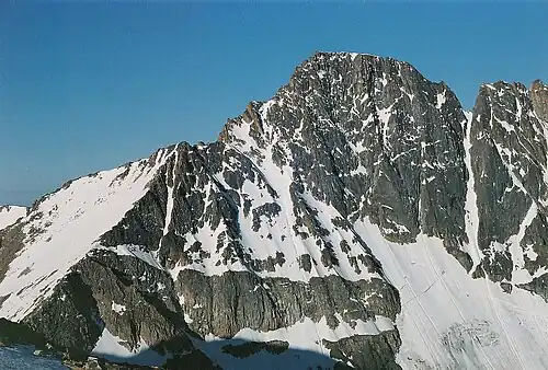
 Granite Peak
 -
 Crazy Peak
 -
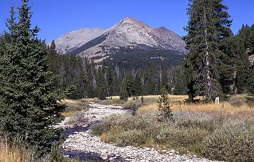 Electric Peak
 -
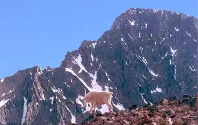
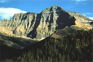 Mount Cleveland
 -
 Trapper Peak
 -
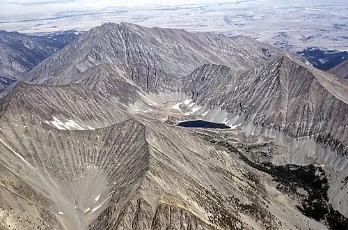
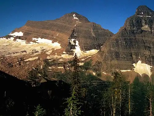
_(14804753253).jpg) Mount Stimson in 1917
Mount Stimson in 1917 -
 Kintla Peak
 -
 McDonald Peak
See also
- List of mountain peaks of North America
- List of mountain peaks of Greenland
- List of mountain peaks of Canada
- List of mountain peaks of the Rocky Mountains
- List of mountain peaks of the United States
- List of mountain peaks of Alaska
- List of mountain peaks of Arizona
- List of mountain peaks of California
- List of mountain peaks of Colorado
- List of mountain peaks of Hawaiʻi
- List of mountain peaks of Idaho
- List of mountain peaks of Montana
- List of mountain peaks of Nevada
- List of mountain peaks of New Mexico
- List of mountain peaks of Oregon
- List of mountain peaks of Utah
- List of mountain peaks of Washington (state)
- List of mountain peaks of Wyoming
- List of mountain peaks of México
- List of mountain peaks of Central America
- List of mountain peaks of the Caribbean
- Montana
- Geography of Montana
- Category:Mountains of Montana
- Geography of Montana
- Physical geography
- Topography
- Topographic elevation
- Topographic prominence
- Topographic isolation
- Topography
Notes
- ^ a b c The summit of Granite Peak is the highest point of the Beartooth Mountains and the U.S. State of Montana.
- ^ a b The summit of Mount Wood is the highest point of the Granite Range.
- ^ a b The elevation of Mount Wood includes an adjustment of +1.516 m (4.97 ft) from NGVD 29 to NAVD 88.
- ^ a b The summit of Tumble Mountain is the highest point of the Lake Plateau.
- ^ a b c The summit of Hilgard Peak is the highest point of the Madison Range.
- ^ a b c The elevation of Hilgard Peak includes an adjustment of +1.49 m (4.89 ft) from NGVD 29 to NAVD 88.
- ^ The elevation of Mount Douglas includes an adjustment of +1.501 m (4.92 ft) from NGVD 29 to NAVD 88.
- ^ a b The elevation of Mount Cowen includes an adjustment of +1.469 m (4.82 ft) from NGVD 29 to NAVD 88.
- ^ a b c The summit of Crazy Peak is the highest point of the Crazy Mountains.
- ^ a b c The elevation of Crazy Peak includes an adjustment of +1.421 m (4.66 ft) from NGVD 29 to NAVD 88.
- ^ The elevation of Two Sisters includes an adjustment of +1.398 m (4.59 ft) from NGVD 29 to NAVD 88.
- ^ a b c The elevation of Lone Mountain includes an adjustment of +1.482 m (4.86 ft) from NGVD 29 to NAVD 88.
- ^ a b c The summit of Tweedy Mountain is the highest point of the Pioneer Mountains.
- ^ a b c The elevation of Tweedy Mountain includes an adjustment of +1.598 m (5.24 ft) from NGVD 29 to NAVD 88.
- ^ a b The elevation of Gallatin Peak includes an adjustment of +1.52 m (4.99 ft) from NGVD 29 to NAVD 88.
- ^ a b c The summit of Electric Peak is the highest point of the Gallatin Range.
- ^ The elevation of Sphinx Mountain includes an adjustment of +1.495 m (4.9 ft) from NGVD 29 to NAVD 88.
- ^ a b c The summit of West Goat Peak is the highest point of the Anaconda Range.
- ^ a b c The elevation of West Goat Peak includes an adjustment of +1.52 m (4.99 ft) from NGVD 29 to NAVD 88.
- ^ The elevation of Cutoff Mountain includes an adjustment of +1.31 m (4.3 ft) from NGVD 29 to NAVD 88.
- ^ a b The elevation of Sage Peak includes an adjustment of +1.438 m (4.72 ft) from NGVD 29 to NAVD 88.
- ^ a b The elevation of Mount Evans includes an adjustment of +1.543 m (5.06 ft) from NGVD 29 to NAVD 88.
- ^ a b c The summit of Homer Youngs Peak is the highest point of the West Big Hole Mountains.
- ^ a b c The elevation of Homer Youngs Peak includes an adjustment of +1.483 m (4.87 ft) from NGVD 29 to NAVD 88.
- ^ a b c The summit of South Sheep Mountain is the highest point of the Lionshead Mountains.
- ^ a b c The elevation of South Sheep Mountain includes an adjustment of +1.431 m (4.69 ft) from NGVD 29 to NAVD 88.
- ^ a b c The summit of Hollowtop Mountain is the highest point of the Tobacco Root Mountains.
- ^ a b c The elevation of Hollowtop Mountain includes an adjustment of +1.486 m (4.88 ft) from NGVD 29 to NAVD 88.
- ^ a b c The summit of Sunset Peak is the highest point of the Snowcrest Range.
- ^ a b c The elevation of Sunset Peak includes an adjustment of +1.553 m (5.1 ft) from NGVD 29 to NAVD 88.
- ^ The elevation of Hogback Mountain includes an adjustment of +1.514 m (4.97 ft) from NGVD 29 to NAVD 88.
- ^ a b c The summit of Black Butte is the highest point of the Gravelly Range.
- ^ a b c The summit elevation of Black Butte includes a vertical offset of +1 m (3.3 ft) from the station benchmark.
- ^ a b c The summit of Mount Cleveland is the highest point of the Lewis Range.
- ^ The elevation of Sliderock Mountain includes an adjustment of +1.49 m (4.89 ft) from NGVD 29 to NAVD 88.
- ^ a b The elevation of Mount Chisholm includes an adjustment of +1.532 m (5.03 ft) from NGVD 29 to NAVD 88.
- ^ a b The elevation of Fan Mountain includes an adjustment of +1.42 m (4.66 ft) from NGVD 29 to NAVD 88.
- ^ a b c The summit of Table Mountain is the highest point of the Highland Mountains.
- ^ a b c The elevation of Table Mountain includes an adjustment of +1.467 m (4.81 ft) from NGVD 29 to NAVD 88.
- ^ a b c The summit of Mount Jefferson is the highest point of the Centennial Mountains.
- ^ a b c Mount Jefferson lies on the Continental Divide of the Americas between Idaho and Montana.
- ^ a b c The summit of Mount Powell is the highest point of the Flint Creek Range.
- ^ a b c The summit of Trapper Peak is the highest point of the central Bitterroot Range.
- ^ a b c The elevation of Trapper Peak includes an adjustment of +1.367 m (4.48 ft) from NGVD 29 to NAVD 88.
- ^ a b c The summit of Kintla Peak is the highest point of the Livingston Range.
- ^ a b c The elevation of Kintla Peak includes an adjustment of +1.413 m (4.64 ft) from NGVD 29 to NAVD 88.
- ^ a b The elevation of Mount Jackson includes an adjustment of +1.425 m (4.68 ft) from NGVD 29 to NAVD 88.
- ^ a b The elevation of Mount Siyeh includes an adjustment of +1.435 m (4.71 ft) from NGVD 29 to NAVD 88.
- ^ a b The elevation of Mount Merritt includes an adjustment of +1.372 m (4.5 ft) from NGVD 29 to NAVD 88.
- ^ The elevation of El Capitan includes an adjustment of +1.251 m (4.1 ft) from NGVD 29 to NAVD 88.
- ^ a b The elevation of Baldy Mountain includes an adjustment of +1.436 m (4.71 ft) from NGVD 29 to NAVD 88.
- ^ a b The elevation of Rainbow Peak includes an adjustment of +1.362 m (4.47 ft) from NGVD 29 to NAVD 88.
- ^ Taylor Mountain lies on the Continental Divide of the Americas between Idaho and Montana.
- ^ a b c The summit of McDonald Peak is the highest point of the Mission Range.
- ^ a b c The elevation of McDonald Peak includes an adjustment of +1.318 m (4.32 ft) from NGVD 29 to NAVD 88.
- ^ a b c The summit of Sacagawea Peak (Bridger Range, Montana) is the highest point of the Bridger Range.
- ^ The summit of Mount Edith is the highest point of the Big Belt Mountains.
- ^ The elevation of Mount Edith includes an adjustment of +1.249 m (4.1 ft) from NGVD 29 to NAVD 88.
- ^ a b c The summit of Crow Peak is the highest point of the Elkhorn Mountains.
- ^ a b c The elevation of Crow Peak includes an adjustment of +1.353 m (4.44 ft) from NGVD 29 to NAVD 88.
- ^ a b c The summit of Red Mountain is the highest point of the Flathead Range.
- ^ a b The summit of Snowshoe Peak is the highest point of the Cabinet Mountains.
- ^ a b The elevation of Snowshoe Peak includes an adjustment of +1.367 m (4.48 ft) from NGVD 29 to NAVD 88.
- ^ a b The summit of Northwest Peak is the highest point of the Buckhorn Mountains.
- ^ a b The elevation of Northwest Peak includes an adjustment of +1.339 m (4.39 ft) from NGVD 29 to NAVD 88.
- ^ a b The summit of Big Pryor Mountain is the highest point of the Pryor Mountains.
- ^ a b The summit of Baldy Mountain is the highest point of the Bearpaw Mountains.
- ^ a b The summit of Mount Edith is the highest point of the Big Belt Mountains.
- ^ a b The elevation of Mount Edith includes an adjustment of +1.249 m (4.1 ft) from NGVD 29 to NAVD 88.
- ^ a b The summit of Greathouse Peak is the highest point of the Big Snowy Mountains.
- ^ a b The elevation of Greathouse Peak includes an adjustment of +1.136 m (3.73 ft) from NGVD 29 to NAVD 88.
- ^ a b The summit of Holland Peak is the highest point of the Swan Range.
- ^ a b The summit of Ch-paa-qn Peak is the highest point of the Reservation Divide.
- ^ a b The summit of McLeod Peak is the highest point of the Rattlesnake Mountains.
- ^ a b The summit of West Butte is the highest point of the Sweetgrass Hills.
- ^ a b The elevation of West Butte includes an adjustment of +1.061 m (3.48 ft) from NGVD 29 to NAVD 88.
- ^ a b The summit of Big Baldy Mountain is the highest point of the Little Belt Mountains.
- ^ a b The elevation of Big Baldy Mountain includes an adjustment of +1.183 m (3.88 ft) from NGVD 29 to NAVD 88.
- ^ a b The summit of Highwood Baldy is the highest point of the Highwood Mountains.
- ^ a b The summit of Rocky Mountain is the highest point of the Rocky Mountain Front.
- ^ a b The summit of Antoine Butte is the highest point of the Little Rocky Mountains.
- ^ a b The elevation of Antoine Butte includes an adjustment of +0.875 m (2.87 ft) from NGVD 29 to NAVD 88.
References
- ^ This article defines a significant summit as a summit with at least 100 meters (328.1 feet) of topographic prominence, and a major summit as a summit with at least 500 meters (1640 feet) of topographic prominence. All summits in this article have at least 500 meters of topographic prominence. An ultra-prominent summit is a summit with at least 1500 meters (4921 feet) of topographic prominence.
- ^ All elevations in this article include an elevation adjustment from the National Geodetic Vertical Datum of 1929 (NGVD 29) to the North American Vertical Datum of 1988 (NAVD 88). For further information, please see this United States National Geodetic Survey note.
- ^ a b If the elevation or prominence of a summit is calculated as a range of values, the arithmetic mean is shown.
- ^ The topographic prominence of a summit is the topographic elevation difference between the summit and its highest or key col to a higher summit. The summit may be near its key col or quite far away. The key col for Denali in Alaska is the Isthmus of Rivas in Nicaragua, 7642 kilometers (4749 miles) away.
- ^ The topographic isolation of a summit is the great-circle distance to its nearest point of equal elevation.
- ^ a b c "GRANITE PEAK". Datasheet for NGS Station QW0616. U.S. National Geodetic Survey. Retrieved June 14, 2016.
- ^ a b c "Granite Peak". Geographic Names Information System. United States Geological Survey, United States Department of the Interior.
- ^ a b c "Granite Peak". Peakbagger.com. Retrieved June 14, 2016.
- ^ a b c "Granite Peak". Bivouac.com. Retrieved June 14, 2016.
- ^ a b "Mount Wood". Geographic Names Information System. United States Geological Survey, United States Department of the Interior.
- ^ a b "Mount Wood". Peakbagger.com. Retrieved June 14, 2016.
- ^ a b "Mount Wood". Bivouac.com. Retrieved June 14, 2016.
- ^ a b "PLATEAU". Datasheet for NGS Station QW0613. U.S. National Geodetic Survey. Retrieved June 14, 2016.
- ^ a b "Castle Mountain". Geographic Names Information System. United States Geological Survey, United States Department of the Interior.
- ^ a b "Castle Mountain". Peakbagger.com. Retrieved June 14, 2016.
- ^ a b "Castle Mountain". Bivouac.com. Retrieved June 14, 2016.
- ^ a b "TUMBLE". Datasheet for NGS Station QX0680. U.S. National Geodetic Survey. Retrieved June 14, 2016.
- ^ a b "Tumble Mountain". Geographic Names Information System. United States Geological Survey, United States Department of the Interior.
- ^ a b "Tumble Mountain". Peakbagger.com. Retrieved June 14, 2016.
- ^ a b "Tumble Mountain". Bivouac.com. Retrieved June 14, 2016.
- ^ a b c "Hilgard Peak". Geographic Names Information System. United States Geological Survey, United States Department of the Interior.
- ^ a b c "Hilgard Peak". Peakbagger.com. Retrieved June 14, 2016.
- ^ a b c "Hilgard Peak". Bivouac.com. Retrieved June 14, 2016.
- ^ "Mount Douglas". Geographic Names Information System. United States Geological Survey, United States Department of the Interior.
- ^ "Mount Douglas". Peakbagger.com. Retrieved June 14, 2016.
- ^ "Mount Douglas". Bivouac.com. Retrieved June 14, 2016.
- ^ a b "Mount Cowen". Geographic Names Information System. United States Geological Survey, United States Department of the Interior.
- ^ a b "Mount Cowen". Peakbagger.com. Retrieved June 14, 2016.
- ^ a b "Mount Cowen". Bivouac.com. Retrieved June 14, 2016.
- ^ a b c "Crazy Peak". Geographic Names Information System. United States Geological Survey, United States Department of the Interior.
- ^ a b c "Crazy Peak". Peakbagger.com. Retrieved June 14, 2016.
- ^ a b c "Crazy Peak". Bivouac.com. Retrieved June 14, 2016.
- ^ "Two Sisters". Geographic Names Information System. United States Geological Survey, United States Department of the Interior.
- ^ "Two Sisters". Peakbagger.com. Retrieved June 14, 2016.
- ^ "Two Sisters". Bivouac.com. Retrieved June 14, 2016.
- ^ a b c "Lone Mountain". Geographic Names Information System. United States Geological Survey, United States Department of the Interior.
- ^ a b c "Lone Mountain". Peakbagger.com. Retrieved June 14, 2016.
- ^ a b c "Lone Mountain". Bivouac.com. Retrieved June 14, 2016.
- ^ a b c "TWEEDY MTN SOUTH PEAK". Datasheet for NGS Station QY0549. U.S. National Geodetic Survey. Retrieved June 14, 2016.
- ^ a b c "Tweedy Mountain". Geographic Names Information System. United States Geological Survey, United States Department of the Interior.
- ^ a b c "Tweedy Mountain". Peakbagger.com. Retrieved June 14, 2016.
- ^ a b c "Tweedy Mountain". Bivouac.com. Retrieved June 14, 2016.
- ^ a b "Gallatin Peak". Geographic Names Information System. United States Geological Survey, United States Department of the Interior.
- ^ a b "Gallatin Peak". Peakbagger.com. Retrieved June 14, 2016.
- ^ a b c "ELECTRIC RM 2". Datasheet for NGS Station QX0707. U.S. National Geodetic Survey. Retrieved June 14, 2016.
- ^ a b c "Electric Peak". Geographic Names Information System. United States Geological Survey, United States Department of the Interior.
- ^ a b c "Electric Peak". Peakbagger.com. Retrieved June 14, 2016.
- ^ a b c "GARFIELD". Datasheet for NGS Station PZ0710. U.S. National Geodetic Survey. Retrieved June 14, 2016.
- ^ a b c "Garfield Mountain (Montana)". Geographic Names Information System. United States Geological Survey, United States Department of the Interior.
- ^ a b c "Garfield Mountain (Montana)". Peakbagger.com. Retrieved June 14, 2016.
- ^ a b c "Garfield Mountain (Montana)". Bivouac.com. Retrieved June 14, 2016.
- ^ a b "EMIGRANT". Datasheet for NGS Station QX0697. U.S. National Geodetic Survey. Retrieved June 14, 2016.
- ^ a b "Emigrant Peak". Geographic Names Information System. United States Geological Survey, United States Department of the Interior.
- ^ a b "Emigrant Peak". Peakbagger.com. Retrieved June 14, 2016.
- ^ a b "Emigrant Peak". Bivouac.com. Retrieved June 14, 2016.
- ^ "Sphinx Mountain". Geographic Names Information System. United States Geological Survey, United States Department of the Interior.
- ^ "Sphinx Mountain". Peakbagger.com. Retrieved June 14, 2016.
- ^ "Sphinx Mountain". Bivouac.com. Retrieved June 14, 2016.
- ^ a b c "West Goat Peak". Geographic Names Information System. United States Geological Survey, United States Department of the Interior.
- ^ a b c "West Goat Peak". Peakbagger.com. Retrieved June 14, 2016.
- ^ a b c "West Goat Peak". Bivouac.com. Retrieved June 14, 2016.
- ^ "Cutoff Mountain". Geographic Names Information System. United States Geological Survey, United States Department of the Interior.
- ^ "Cutoff Mountain". Peakbagger.com. Retrieved June 14, 2016.
- ^ "Cutoff Mountain". Bivouac.com. Retrieved June 14, 2016.
- ^ a b "Sage Peak". Geographic Names Information System. United States Geological Survey, United States Department of the Interior.
- ^ a b "Sage Peak". Peakbagger.com. Retrieved June 14, 2016.
- ^ a b "Sage Peak". Bivouac.com. Retrieved June 14, 2016.
- ^ a b "Mount Evans". Geographic Names Information System. United States Geological Survey, United States Department of the Interior.
- ^ a b "Mount Evans". Peakbagger.com. Retrieved June 14, 2016.
- ^ a b "Mount Evans". Bivouac.com. Retrieved June 14, 2016.
- ^ a b c "Homer Youngs Peak". Geographic Names Information System. United States Geological Survey, United States Department of the Interior.
- ^ a b c "Homer Youngs Peak". Peakbagger.com. Retrieved June 14, 2016.
- ^ a b c "Homer Youngs Peak". Bivouac.com. Retrieved June 14, 2016.
- ^ a b c "South Sheep Mountain". Peakbagger.com. Retrieved June 14, 2016.
- ^ a b c "South Sheep Mountain". Bivouac.com. Retrieved June 14, 2016.
- ^ a b c "Hollowtop Mountain". Geographic Names Information System. United States Geological Survey, United States Department of the Interior.
- ^ a b c "Hollowtop Mountain". Peakbagger.com. Retrieved June 14, 2016.
- ^ a b c "Hollowtop Mountain". Bivouac.com. Retrieved June 14, 2016.
- ^ a b c "Sunset Peak". Geographic Names Information System. United States Geological Survey, United States Department of the Interior.
- ^ a b c "Sunset Peak". Peakbagger.com. Retrieved June 14, 2016.
- ^ a b c "Sunset Peak". Bivouac.com. Retrieved June 14, 2016.
- ^ "Hogback Mountain". Geographic Names Information System. United States Geological Survey, United States Department of the Interior.
- ^ "Hogback Mountain". Peakbagger.com. Retrieved June 14, 2016.
- ^ "Hogback Mountain". Bivouac.com. Retrieved June 14, 2016.
- ^ a b c "BLACK BUTTE RESET". Datasheet for NGS Station PY1200. U.S. National Geodetic Survey. Retrieved June 14, 2016.
- ^ a b c "Black Butte". Geographic Names Information System. United States Geological Survey, United States Department of the Interior.
- ^ a b c "Black Butte". Peakbagger.com. Retrieved June 14, 2016.
- ^ a b c "Black Butte". Bivouac.com. Retrieved June 14, 2016.
- ^ a b "SHEEP MTN". Datasheet for NGS Station QX0701. U.S. National Geodetic Survey. Retrieved June 14, 2016.
- ^ a b "Sheep Mountain". Geographic Names Information System. United States Geological Survey, United States Department of the Interior.
- ^ a b "Sheep Mountain". Peakbagger.com. Retrieved June 14, 2016.
- ^ a b "Sheep Mountain". Bivouac.com. Retrieved June 14, 2016.
- ^ a b c "CLEVELAND". Datasheet for NGS Station TM1009. U.S. National Geodetic Survey. Retrieved June 14, 2016.
- ^ a b c "Mount Cleveland". Geographic Names Information System. United States Geological Survey, United States Department of the Interior.
- ^ a b c "Mount Cleveland". Peakbagger.com. Retrieved June 14, 2016.
- ^ a b c "Mount Cleveland". Bivouac.com. Retrieved June 14, 2016.
- ^ "Sliderock Mountain". Geographic Names Information System. United States Geological Survey, United States Department of the Interior.
- ^ "Sliderock Mountain". Peakbagger.com. Retrieved June 14, 2016.
- ^ "Sliderock Mountain". Bivouac.com. Retrieved June 14, 2016.
- ^ a b "Mount Chisholm". Geographic Names Information System. United States Geological Survey, United States Department of the Interior.
- ^ a b "Mount Chisholm". Peakbagger.com. Retrieved June 14, 2016.
- ^ a b "Mount Chisholm". Bivouac.com. Retrieved June 14, 2016.
- ^ a b "Fan Mountain". Geographic Names Information System. United States Geological Survey, United States Department of the Interior.
- ^ a b "Fan Mountain". Peakbagger.com. Retrieved June 14, 2016.
- ^ a b c "TABLE MTN". Datasheet for NGS Station QY0501. U.S. National Geodetic Survey. Retrieved June 14, 2016.
- ^ a b c "Table Mountain". Geographic Names Information System. United States Geological Survey, United States Department of the Interior.
- ^ a b c "Table Mountain". Peakbagger.com. Retrieved June 14, 2016.
- ^ a b c "Table Mountain". Bivouac.com. Retrieved June 14, 2016.
- ^ a b c "SAWTELLE". Datasheet for NGS Station PY1196. U.S. National Geodetic Survey. Retrieved June 14, 2016.
- ^ a b c "Mount Jefferson". Geographic Names Information System. United States Geological Survey, United States Department of the Interior.
- ^ a b c "Mount Jefferson". Peakbagger.com. Retrieved June 14, 2016.
- ^ a b c "Mount Jefferson". Bivouac.com. Retrieved June 14, 2016.
- ^ a b c "POWELL ET". Datasheet for NGS Station RX1032. U.S. National Geodetic Survey. Retrieved June 14, 2016.
- ^ a b c "Mount Powell". Geographic Names Information System. United States Geological Survey, United States Department of the Interior.
- ^ a b c "Mount Powell". Peakbagger.com. Retrieved June 14, 2016.
- ^ a b c "Trapper Peak". Geographic Names Information System. United States Geological Survey, United States Department of the Interior.
- ^ a b c "Trapper Peak". Peakbagger.com. Retrieved June 14, 2016.
- ^ a b c "Trapper Peak". Bivouac.com. Retrieved June 14, 2016.
- ^ a b c "STIMSON". Datasheet for NGS Station TM0942. U.S. National Geodetic Survey. Retrieved June 14, 2016.
- ^ a b c "Mount Stimson". Geographic Names Information System. United States Geological Survey, United States Department of the Interior.
- ^ a b c "Mount Stimson". Peakbagger.com. Retrieved June 14, 2016.
- ^ a b c "Mount Stimson". Bivouac.com. Retrieved June 14, 2016.
- ^ a b c "Kintla Peak". Geographic Names Information System. United States Geological Survey, United States Department of the Interior.
- ^ a b c "Kintla Peak". Peakbagger.com. Retrieved June 14, 2016.
- ^ a b c "Kintla Peak". Bivouac.com. Retrieved June 14, 2016.
- ^ a b "Mount Jackson". Geographic Names Information System. United States Geological Survey, United States Department of the Interior.
- ^ a b "Mount Jackson". Peakbagger.com. Retrieved June 14, 2016.
- ^ a b "Mount Jackson". Bivouac.com. Retrieved June 14, 2016.
- ^ a b "Mount Siyeh". Geographic Names Information System. United States Geological Survey, United States Department of the Interior.
- ^ a b "Mount Siyeh". Peakbagger.com. Retrieved June 14, 2016.
- ^ a b "Mount Siyeh". Bivouac.com. Retrieved June 14, 2016.
- ^ a b "Mount Merritt". Geographic Names Information System. United States Geological Survey, United States Department of the Interior.
- ^ a b "Mount Merritt". Peakbagger.com. Retrieved June 14, 2016.
- ^ a b "Mount Merritt". Bivouac.com. Retrieved June 14, 2016.
- ^ "El Capitan". Geographic Names Information System. United States Geological Survey, United States Department of the Interior.
- ^ "El Capitan". Peakbagger.com. Retrieved June 14, 2016.
- ^ "El Capitan". Bivouac.com. Retrieved June 14, 2016.
- ^ a b "Baldy Mountain". Geographic Names Information System. United States Geological Survey, United States Department of the Interior.
- ^ a b "Baldy Mountain". Peakbagger.com. Retrieved June 14, 2016.
- ^ a b "Baldy Mountain". Bivouac.com. Retrieved June 14, 2016.
- ^ a b "Rainbow Peak". Geographic Names Information System. United States Geological Survey, United States Department of the Interior.
- ^ a b "Rainbow Peak". Peakbagger.com. Retrieved June 14, 2016.
- ^ a b "Rainbow Peak". Bivouac.com. Retrieved June 14, 2016.
- ^ "GLO POST 10". Datasheet for NGS Station PY1198. U.S. National Geodetic Survey. Retrieved June 14, 2016.
- ^ "Taylor Mountain". Geographic Names Information System. United States Geological Survey, United States Department of the Interior.
- ^ "Taylor Mountain". Peakbagger.com. Retrieved June 14, 2016.
- ^ "Taylor Mountain". Bivouac.com. Retrieved June 14, 2016.
- ^ a b c "McDonald Peak". Geographic Names Information System. United States Geological Survey, United States Department of the Interior.
- ^ a b c "McDonald Peak". Peakbagger.com. Retrieved June 14, 2016.
- ^ a b c "McDonald Peak". Bivouac.com. Retrieved June 14, 2016.
- ^ a b c "ROSS 2". Datasheet for NGS Station QX0748. U.S. National Geodetic Survey. Retrieved June 14, 2016.
- ^ a b c "Sacagawea Peak (Bridger Range, Montana)". Geographic Names Information System. United States Geological Survey, United States Department of the Interior.
- ^ a b c "Sacagawea Peak (Bridger Range, Montana)". Peakbagger.com. Retrieved June 14, 2016.
- ^ a b c "Sacagawea Peak (Bridger Range, Montana)". Bivouac.com. Retrieved June 14, 2016.
- ^ a b c "SAINT JO ET". Datasheet for NGS Station RY1027. U.S. National Geodetic Survey. Retrieved June 14, 2016.
- ^ a b c "Saint Joseph Peak". Geographic Names Information System. United States Geological Survey, United States Department of the Interior.
- ^ a b c "Saint Joseph Peak". Peakbagger.com. Retrieved June 14, 2016.
- ^ a b c "Saint Joseph Peak". Bivouac.com. Retrieved June 14, 2016.
- ^ "Mount Edith". Geographic Names Information System. United States Geological Survey, United States Department of the Interior.
- ^ "Mount Edith". Peakbagger.com. Retrieved June 14, 2016.
- ^ "Mount Edith". Bivouac.com. Retrieved June 14, 2016.
- ^ a b c "Crow Peak". Geographic Names Information System. United States Geological Survey, United States Department of the Interior.
- ^ a b c "Crow Peak". Peakbagger.com. Retrieved June 14, 2016.
- ^ a b c "RED". Datasheet for NGS Station ST0521. U.S. National Geodetic Survey. Retrieved June 14, 2016.
- ^ a b c "Red Mountain". Geographic Names Information System. United States Geological Survey, United States Department of the Interior.
- ^ a b c "Red Mountain". Peakbagger.com. Retrieved June 14, 2016.
- ^ a b c "Red Mountain". Bivouac.com. Retrieved June 14, 2016.
- ^ a b "Snowshoe Peak". Geographic Names Information System. United States Geological Survey, United States Department of the Interior.
- ^ a b "Snowshoe Peak". Peakbagger.com. Retrieved June 14, 2016.
- ^ a b "Snowshoe Peak". Bivouac.com. Retrieved June 14, 2016.
- ^ a b "NORTHWEST PEAK LOOKOUT". Datasheet for NGS Station TN0958. U.S. National Geodetic Survey. Retrieved June 14, 2016.
- ^ a b "Northwest Peak". Geographic Names Information System. United States Geological Survey, United States Department of the Interior.
- ^ a b "Northwest Peak". Peakbagger.com. Retrieved June 14, 2016.
- ^ a b "Northwest Peak". Bivouac.com. Retrieved June 14, 2016.
- ^ a b "ICE CAVE". Datasheet for NGS Station QW0538. U.S. National Geodetic Survey. Retrieved June 14, 2016.
- ^ a b "Big Pryor Mountain". Geographic Names Information System. United States Geological Survey, United States Department of the Interior.
- ^ a b "Big Pryor Mountain". Peakbagger.com. Retrieved June 14, 2016.
- ^ a b "Big Pryor Mountain". Bivouac.com. Retrieved June 14, 2016.
- ^ a b "BALDY". Datasheet for NGS Station TK0492. U.S. National Geodetic Survey. Retrieved June 14, 2016.
- ^ a b "Baldy Mountain". Geographic Names Information System. United States Geological Survey, United States Department of the Interior.
- ^ a b "Baldy Mountain". Peakbagger.com. Retrieved June 14, 2016.
- ^ a b "Mount Edith". Geographic Names Information System. United States Geological Survey, United States Department of the Interior.
- ^ a b "Mount Edith". Peakbagger.com. Retrieved June 14, 2016.
- ^ a b "Mount Edith". Bivouac.com. Retrieved June 14, 2016.
- ^ a b "BALDY". Datasheet for NGS Station SU0971. U.S. National Geodetic Survey. Retrieved June 14, 2016.
- ^ a b "Baldy Mountain". Geographic Names Information System. United States Geological Survey, United States Department of the Interior.
- ^ a b "Baldy Mountain". Peakbagger.com. Retrieved June 14, 2016.
- ^ a b "Greathouse Peak". Geographic Names Information System. United States Geological Survey, United States Department of the Interior.
- ^ a b "Greathouse Peak". Peakbagger.com. Retrieved June 14, 2016.
- ^ a b "Greathouse Peak". Bivouac.com. Retrieved June 14, 2016.
- ^ a b "HOLLAND". Datasheet for NGS Station ST0612. U.S. National Geodetic Survey. Retrieved June 14, 2016.
- ^ a b "Holland Peak". Geographic Names Information System. United States Geological Survey, United States Department of the Interior.
- ^ a b "Holland Peak". Peakbagger.com. Retrieved June 14, 2016.
- ^ a b "Holland Peak". Bivouac.com. Retrieved June 14, 2016.
- ^ a b "SQUAW PEAK". Datasheet for NGS Station SU0960. U.S. National Geodetic Survey. Retrieved June 14, 2016.
- ^ a b "Ch-paa-qn Peak". Geographic Names Information System. United States Geological Survey, United States Department of the Interior.
- ^ a b "Ch-paa-qn Peak". Peakbagger.com. Retrieved June 14, 2016.
- ^ a b "YAAK". Datasheet for NGS Station TN0902. U.S. National Geodetic Survey. Retrieved June 14, 2016.
- ^ a b "Robinson Mountain (Lincoln County)". Geographic Names Information System. United States Geological Survey, United States Department of the Interior.
- ^ a b "Robinson Mountain (Lincoln County)". Peakbagger.com. Retrieved June 14, 2016.
- ^ a b "Robinson Mountain (Lincoln County)". Bivouac.com. Retrieved June 14, 2016.
- ^ a b "MCLEOD CAIRN". Datasheet for NGS Station ST0598. U.S. National Geodetic Survey. Retrieved June 14, 2016.
- ^ a b "McLeod Peak". Geographic Names Information System. United States Geological Survey, United States Department of the Interior.
- ^ a b "McLeod Peak". Peakbagger.com. Retrieved June 14, 2016.
- ^ a b "MOUNT HEADLEY". Datasheet for NGS Station SU0990. U.S. National Geodetic Survey. Retrieved June 14, 2016.
- ^ a b "Mount Headley". Geographic Names Information System. United States Geological Survey, United States Department of the Interior.
- ^ a b "Mount Headley". Peakbagger.com. Retrieved June 14, 2016.
- ^ a b "West Butte". Geographic Names Information System. United States Geological Survey, United States Department of the Interior.
- ^ a b "West Butte". Peakbagger.com. Retrieved June 14, 2016.
- ^ a b "West Butte". Bivouac.com. Retrieved June 14, 2016.
- ^ a b "Big Baldy Mountain". Geographic Names Information System. United States Geological Survey, United States Department of the Interior.
- ^ a b "Big Baldy Mountain". Peakbagger.com. Retrieved June 14, 2016.
- ^ a b "Big Baldy Mountain". Bivouac.com. Retrieved June 14, 2016.
- ^ a b "HIGHWOOD". Datasheet for NGS Station SS1526. U.S. National Geodetic Survey. Retrieved June 14, 2016.
- ^ a b "Highwood Baldy". Geographic Names Information System. United States Geological Survey, United States Department of the Interior.
- ^ a b "Highwood Baldy". Peakbagger.com. Retrieved June 14, 2016.
- ^ a b "Highwood Baldy". Bivouac.com. Retrieved June 14, 2016.
- ^ a b "ROCKY". Datasheet for NGS Station ST0546. U.S. National Geodetic Survey. Retrieved June 14, 2016.
- ^ a b "Rocky Mountain". Geographic Names Information System. United States Geological Survey, United States Department of the Interior.
- ^ a b "Rocky Mountain". Peakbagger.com. Retrieved June 14, 2016.
- ^ a b "Rocky Mountain". Bivouac.com. Retrieved June 14, 2016.
- ^ a b "Antoine Butte". Geographic Names Information System. United States Geological Survey, United States Department of the Interior.
- ^ a b "Antoine Butte". Peakbagger.com. Retrieved June 14, 2016.
- ^ a b "Antoine Butte". Bivouac.com. Retrieved June 14, 2016.
External links
- United States Geological Survey (USGS)
- United States National Geodetic Survey (NGS)
- Bivouac.com
- Peakbagger.com
- Peaklist.org
- Peakware.com
- Summitpost.org
State of Montana | |
|---|---|
Helena (capital) | |
| Topics |
|
| Society |
|
| Regions |
|
| Largest cities |
|
| Counties |
|